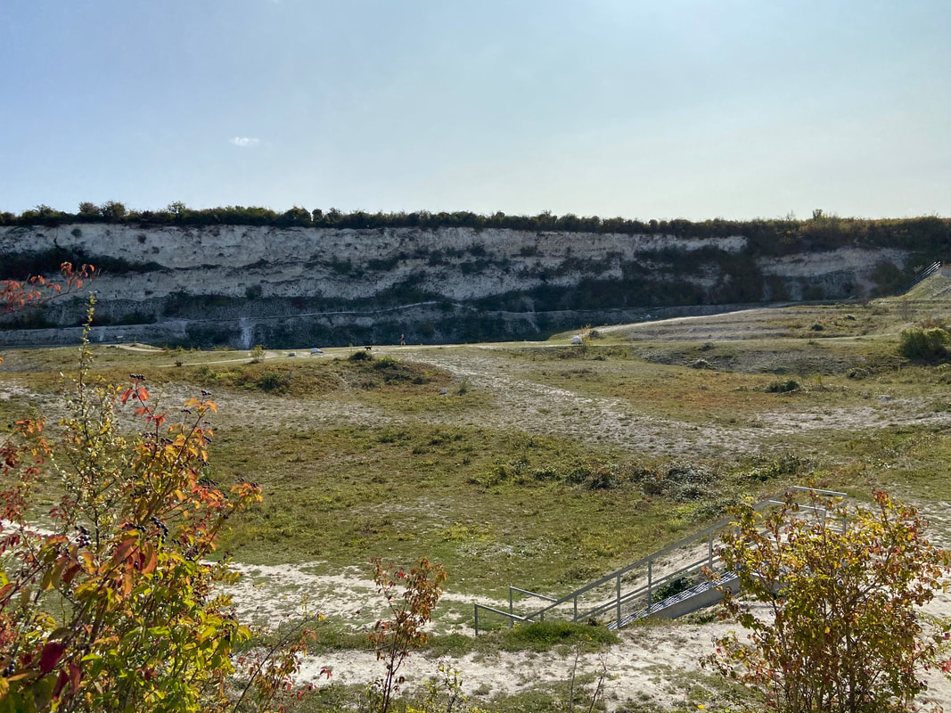
 Cherry Hinton Chalk Pits (East Pit) November 2020 Cherry Hinton Chalk Pits (East Pit) November 2020
UPDATE: April 2024 - War Ditches Report Attached at the end.
I thought I'd give you a little information about the War Ditches, Cherry Hinton, Cambridge, as I am publishing my book on the site soon and so little is publicly known about the history of the site.
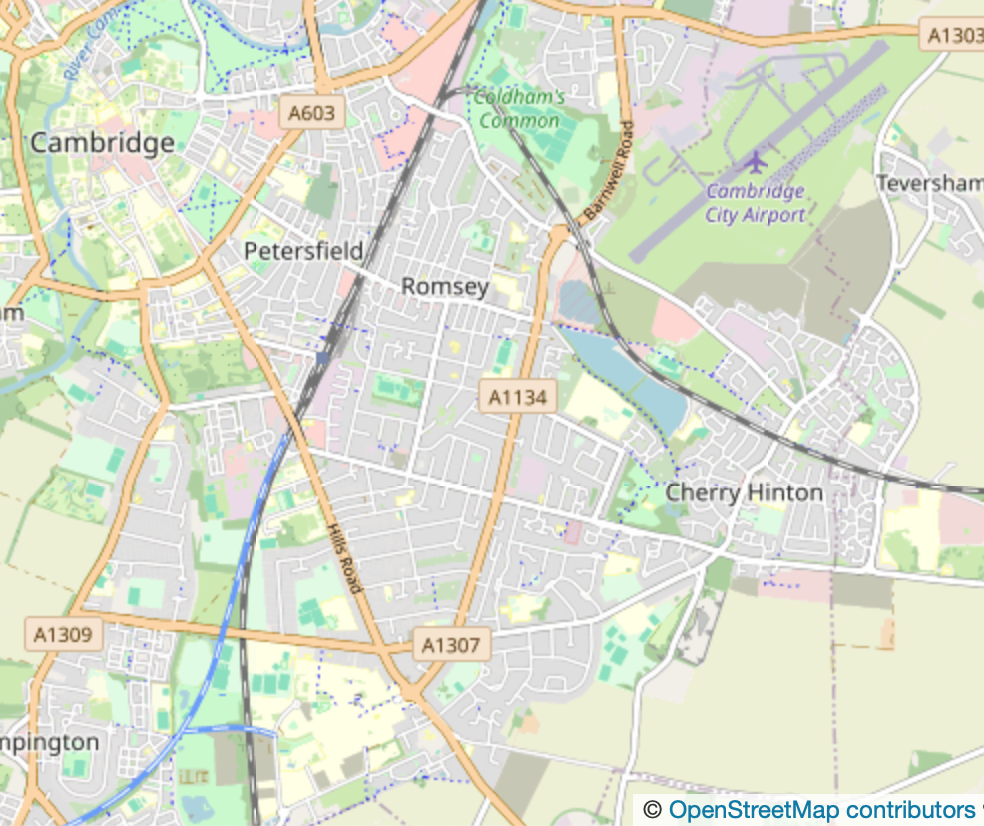
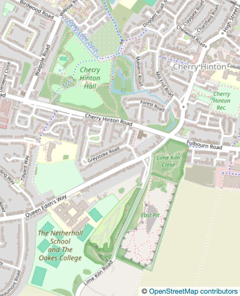
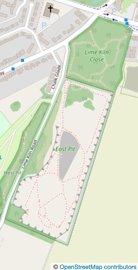
The War Ditches is an iron age hill fort site in Cherry Hinton, southeast of Cambridge City. The site, now almost completely destroyed by chalk quarrying, sits at the top of the most north westerly point of the Gog Magog Hills, on Lime Kiln Hill. The whole site has been occupied since prehistory and all periods are represented by activity on and around the immediate area. Today the site is within the old chalk quarry, now officially called 'East Pit'. It is managed by Cambridgehire Wildlife Trust and is open to the public for free.
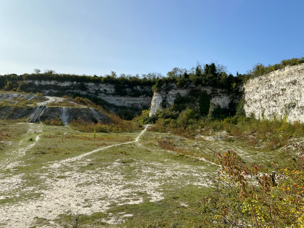
Cherry Hinton Chalk Pits (East Pit) November 2020
Back in 2008 I was out for a walk with my sister and my daughter, we were climbing around in the local chalk pits, which were, back then, a bit wild and not really managed. Us locals would go there to walk, play and explore the massive open chalk pits, which made you feel like you were in some jurassic time slip. Many people in the area today still do not know of this amazing site and if they stumble across it they are amazed it is there.
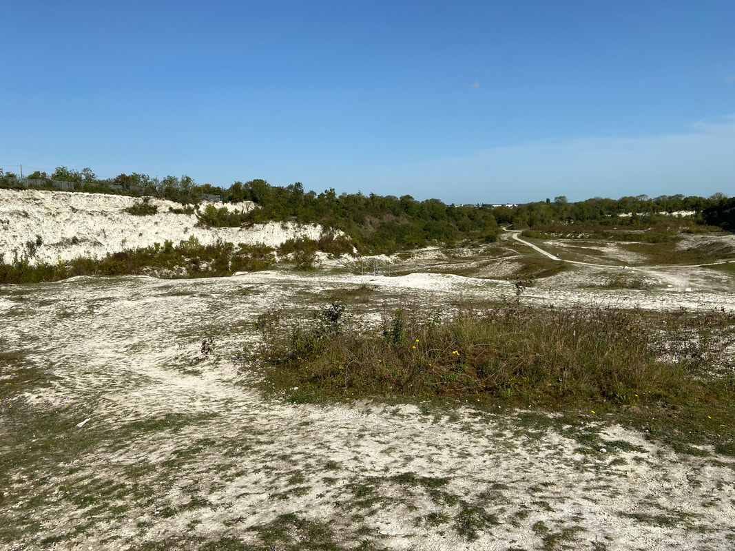
Cherry Hinton Chalks Pits (East Pit) November 2020
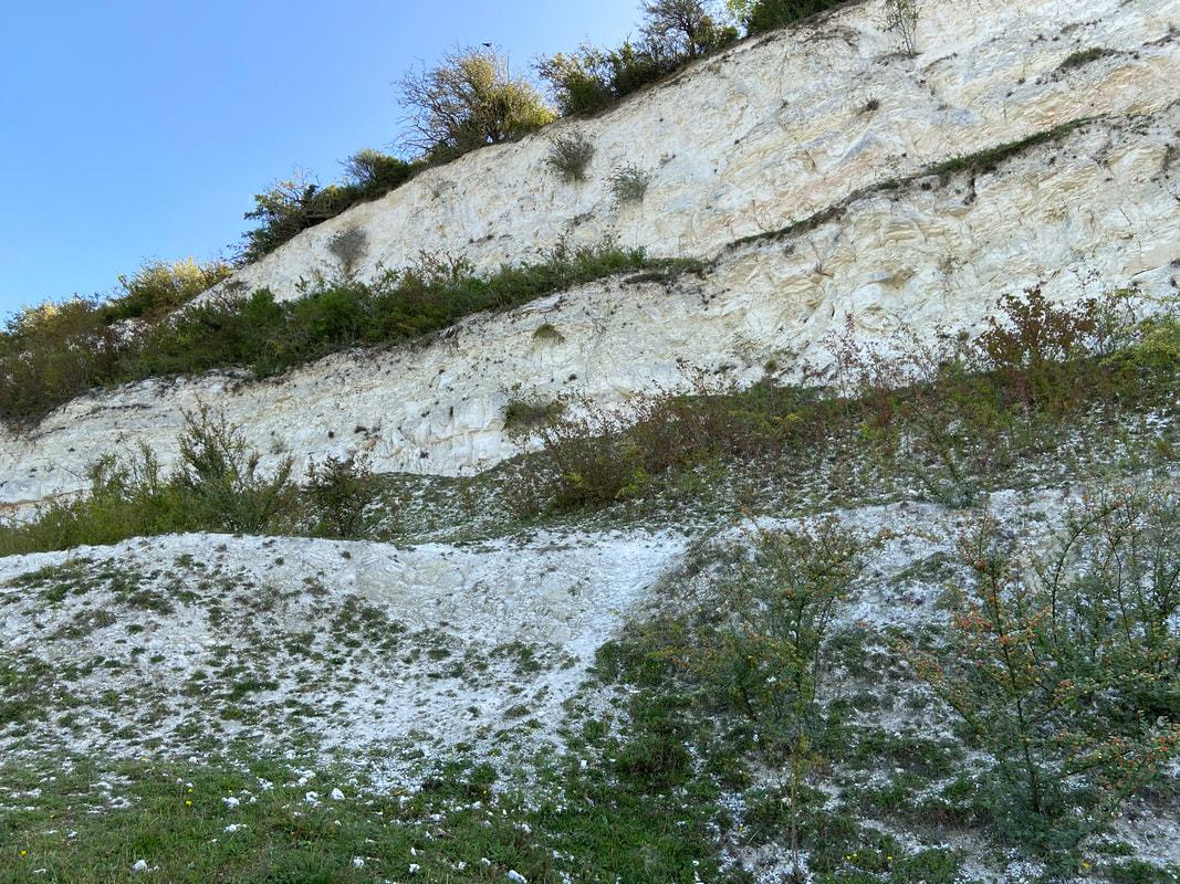
Cherry Hinton Chalk Pits (East Pit) November 2020
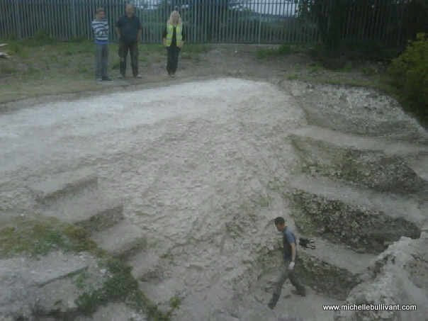
Anyway, back in 2008 on our walk at the chalk pits, we were up on the cliff side (you can't go up on the cliffs anymore!), we were sitting in a small dip and as I poked about in the mud, hand fulls of amazing ancient pottery sherds started to come out. I was Parish Archaeological Warden at the time and knew the history of the area well. We were sitting on the edge of the cliff where chalk quarrying had made a massive deep area and cut away all that had been there previously (see pictures). 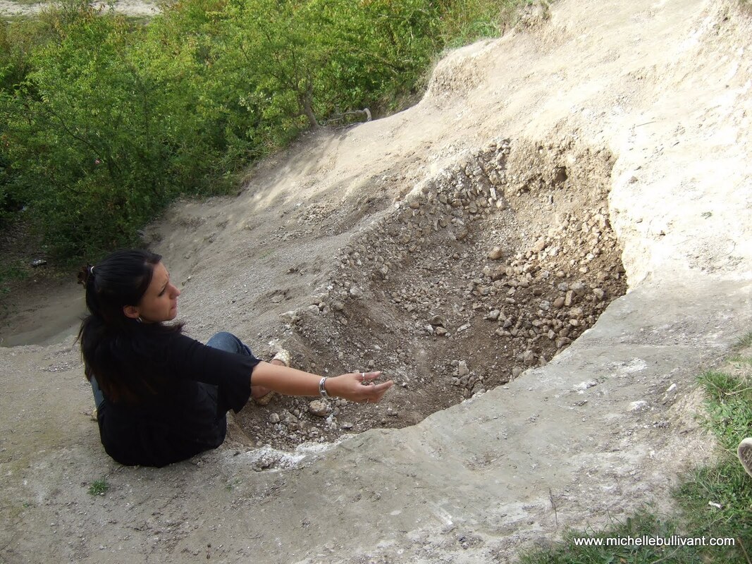 My sister sitting in the small dip, on top of the cliff, in Cherry Hinton Chalk Pits 2008 - filled with ancient pottery - part of the War Ditches rediscovered that afternoon. My sister sitting in the small dip, on top of the cliff, in Cherry Hinton Chalk Pits 2008 - filled with ancient pottery - part of the War Ditches rediscovered that afternoon.
In the late 1800's there had been reports of all kinds of things being discovered on the site and over the years various excavations had taken place alongside the ever encroaching quarrying - all manner of amazing well known antiquarians had been to and worked at the site over the years. The main discovery was that of the 'War Ditches' - a roughly circular ring ditch which was described as being an Iron Age Hill Fort, that had once dominated the top of Lime Kiln Hill - something like that of its neighbour of Wandlebury which is still preserved today, a couple of miles to the south west.
There had been various reports written about the site and the excavations that took place over the years and when the quarrying at the site had finished in the 1970's, the War Ditches was thought to have been finally and fully destroyed by the quarrying, it was written up in books and histories stating that fact. However, I was now armed with a bag full of beautiful pottery sherds dating from the late Iron Age, Romano-British and Roman periods. I knew the position of where the War Ditches had been and I also knew that where we had been sitting, in that small dip on the cliff side could only be one thing - an unknown remaining part of the War Ditches..... 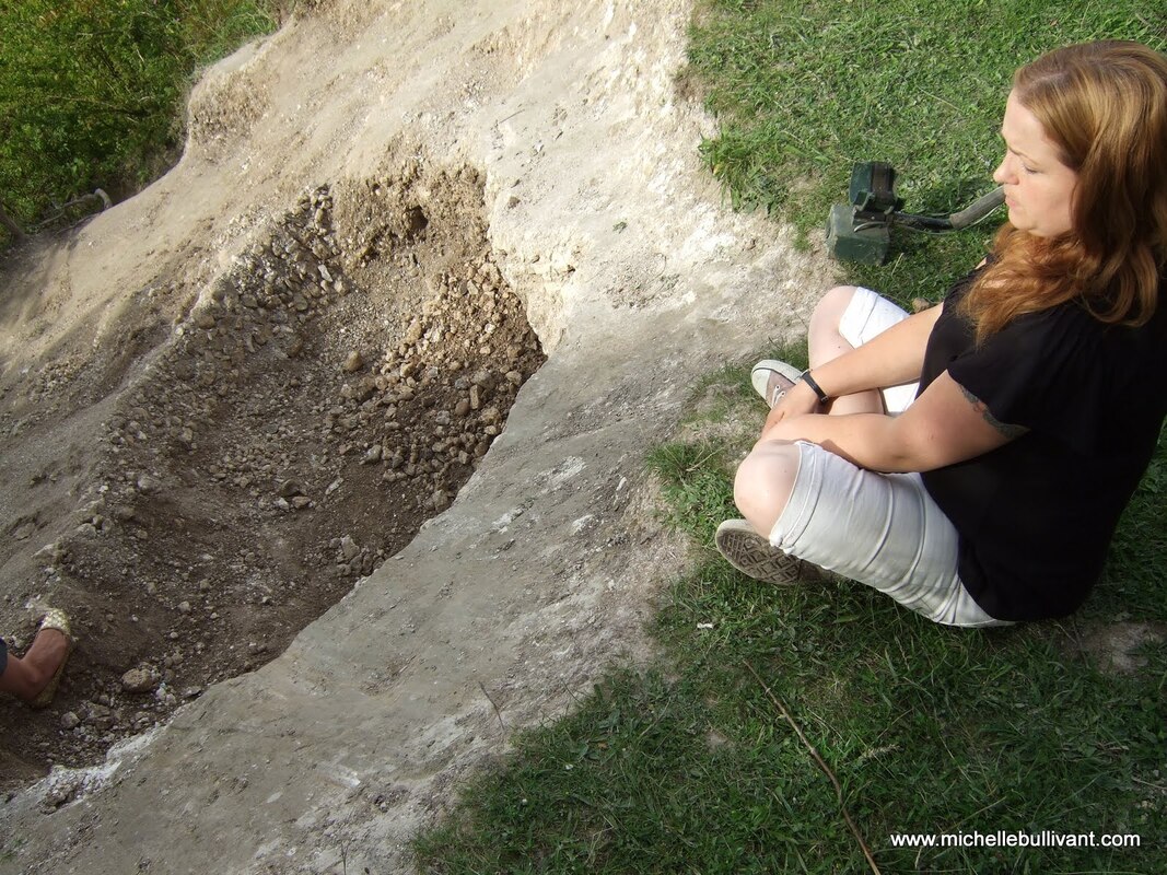
Me sitting at the small dip, on top of the cliff, in Cherry Hinton Chalk Pits 2008 - filled with ancient pottery - part of the War Ditches rediscovered that afternoon.
I quickly phoned my two friends and colleagues Mark Hinman & Richard Mortimer, both of who take an interest in the archaeology of this area, and told them what I had discovered and then drove the bag of pottery over to them for them to have a look. A lot of things happened fairly fast after that. Firstly, we found that the site was in the process of being acquired by Cambridgeshire Wildlife Trust from one of the Cambridge Colleges. Then it turned out that the chap involved with the Wildlife Trust and the acquisition of the site, lived close by. So Mark and I had an emergency meeting with him, at the top of Lime Kiln Hill where we explained what had been discovered. Mark moved quickly, explaining that a full and official archaeological excavation would be needed. Terms were negotiated between The Wildlife Trust, English Heritage and others and the business of the full archaeological excavation was taken on by Oxford Archaeology East (based in Bar Hill Cambridge, this company used to be Cambridgeshire County Council Archaeological Unit). Mark and I also approached Cambridge Antiquarian Society (of which we were both council members of at the time) to tell them of the discovery. Many of the past excavations at the site had been published by the Cambridge Antiquarian Society, since the 19th Century.
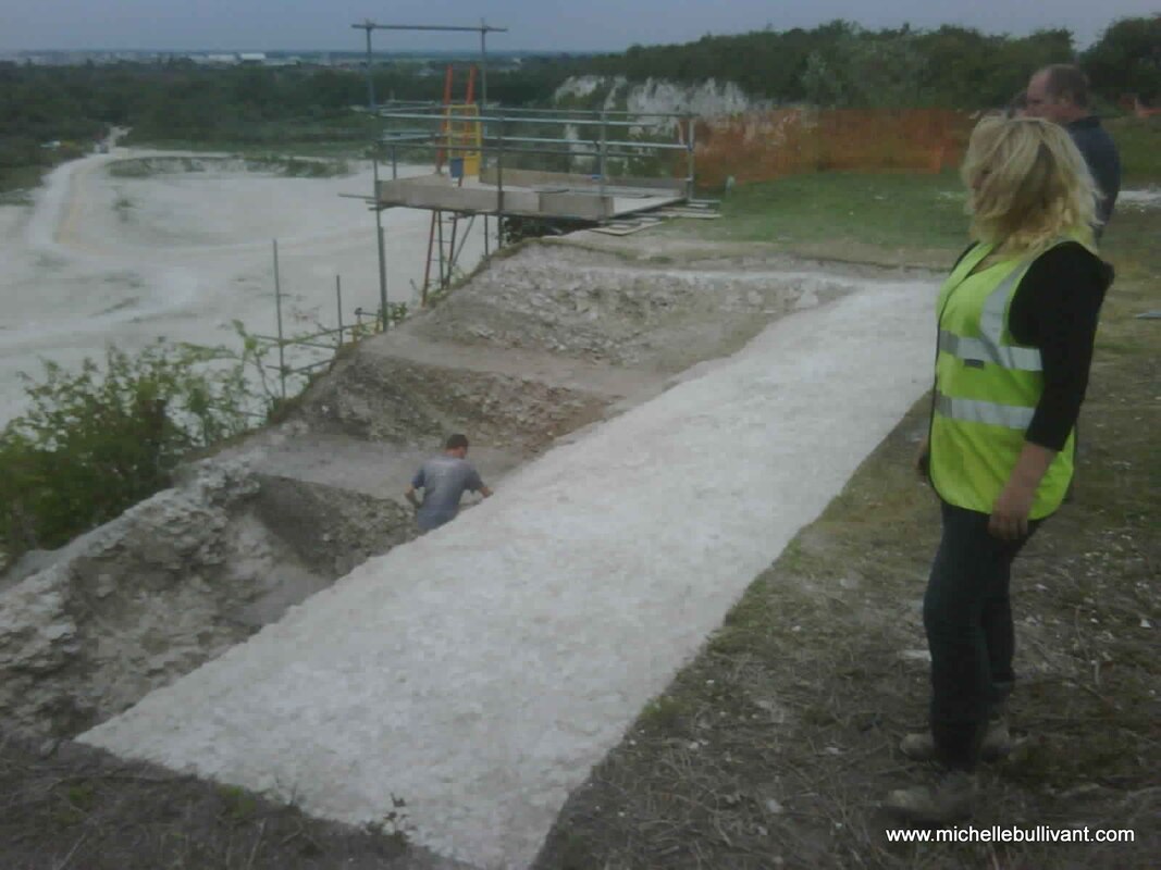
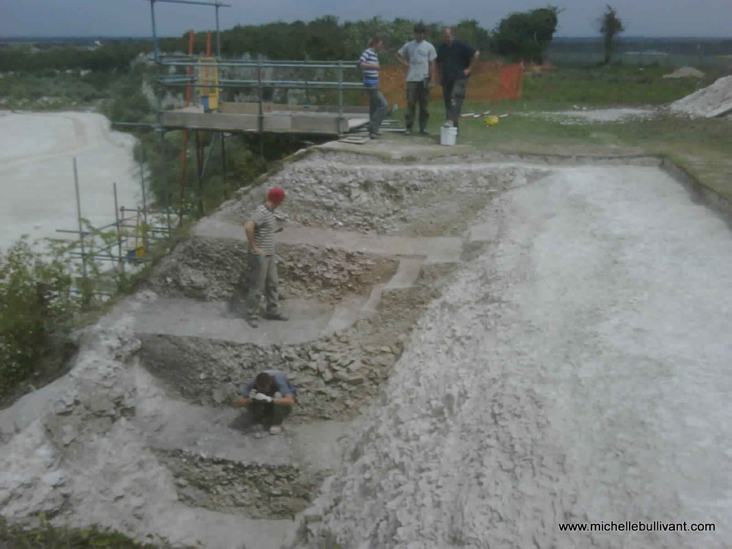
Archaeological Excavation at the War Ditches 2010. I am wearing the yellow viz vest and Richard Mortimer is standing behind me. The hole that I discovered was now opened up into what was a massive, ancient, ring ditch.
While negotiations and preparations for the archaeological excavation were taking place, I then had a phone call from the Cambridge Archaeology Office to tell me that two young boys who had been playing up at the chalk pits had found some human leg bones which had fallen out of the cliff, it wasn't clear which part of the chalk pits these bones were found - it could have been anywhere along the entire cliff. I was asked to pop down to the archaeology lab in Downing Street, Cambridge and collect the bones. A odd experience, which involved me collecting a pair of leg bones in a wooden box, which I then strapped into the front passenger seat of my car. I decided that the best thing was, that as Oxford Archaeology would be carrying out the main excavation on site, that I would deliver the legs to them to be processed by their finds department - even though they may not have fallen out of the actual War Ditches ring ditch itself, they still came from the same area.
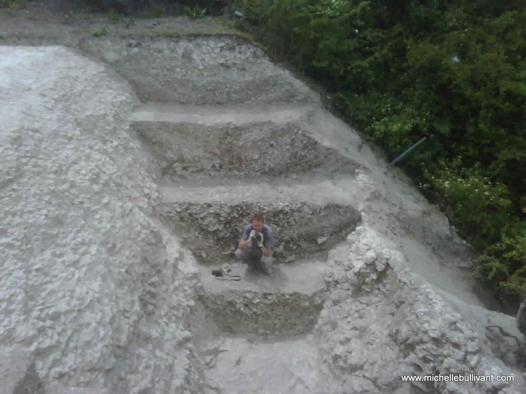
An excavated section of the War Ditches - the bright natural chalk to the left and the ancient ditch fill behind the archaeologist. Cliff face to the right of the picture. 2010
In 2010, the full excavation began in the chalk pits - this was something new for everyone, not least because Cambridgeshire is not known for its high hills or mountains but this excavation was on top of a cliff, so the archaeologists had to be trained in cliff side excavation and safety. A large scale scaffolding unit had to be erected next to the cliff to allow us to access the site safely and training in harness wearing was required for some.
Archaeological excavation at the War Ditches 2010, Cherry Hinton Chalk Pits
Obviously there is so much I want to write about what was found and the whole history the site but for now, I just wanted you to know what had taken place at the chalk pits because so many people have no idea that this site is there or anything about what happened. I will publish the book later this year and you'll be able to find out all the details of what was found both during this excavation and in the past at the site.
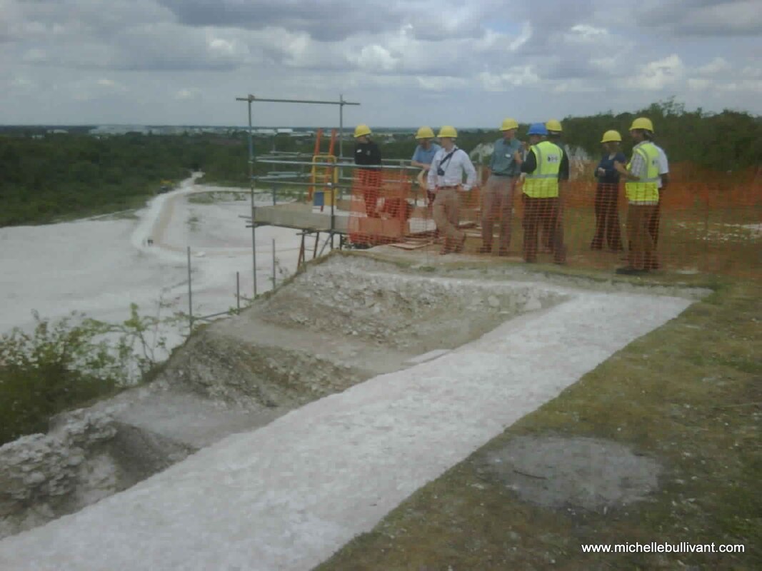
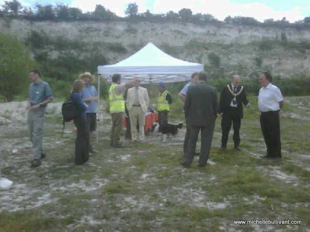
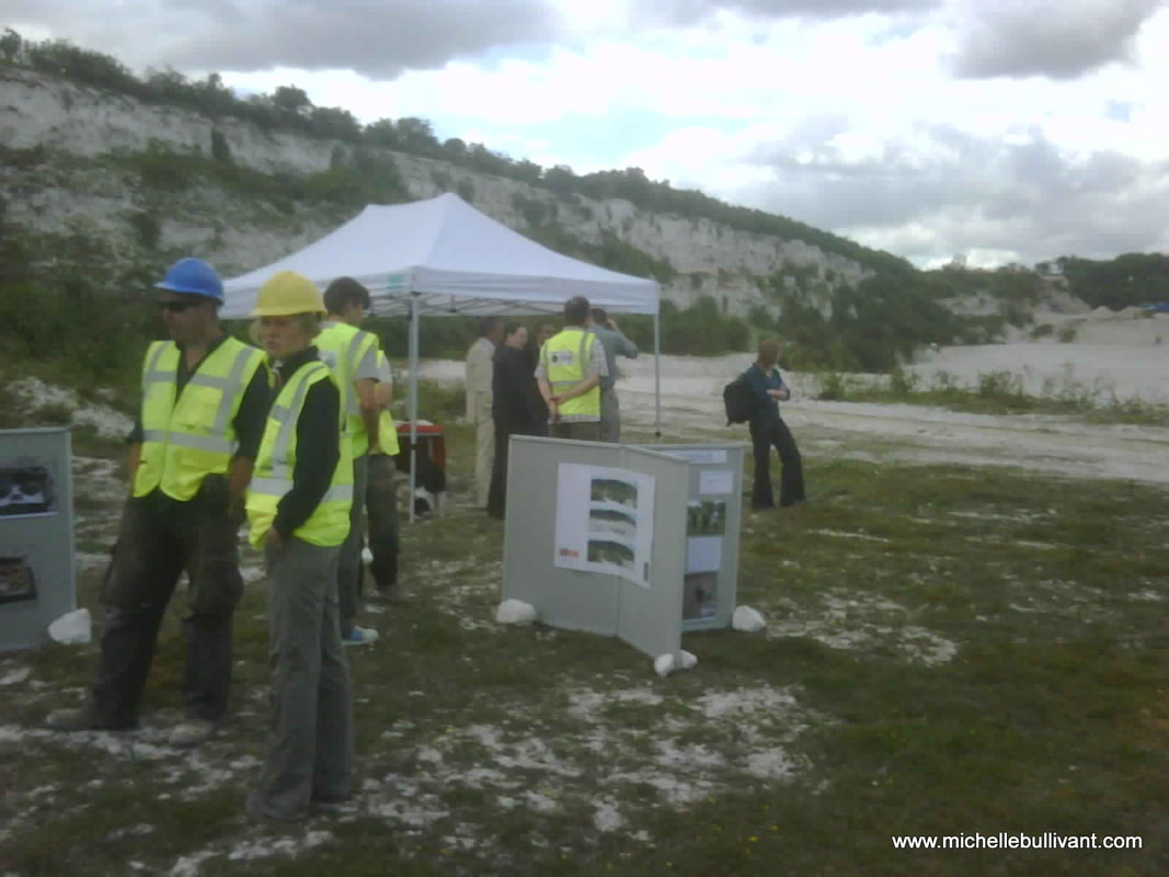
At the end of the excavation in 2010, an open day was held in the chalk pits. The Cambridgeshire Wildlife Trust now owned the site and had called this large chalk pit 'East Pit'. The mayor, press and public were invited to come and see the site and find out what had been taking place. Here are some more pictures from that day and the excavations 2010.
Archaeological excavation of the War Ditches, East Pit. 2010
Archaeological excavation at the War Ditches, East Pit 2010
Open Day at East Pit, Cherry Hinton chalk pits 2010
Open Day at East Pit, Cherry Hinton chalk pits 2010
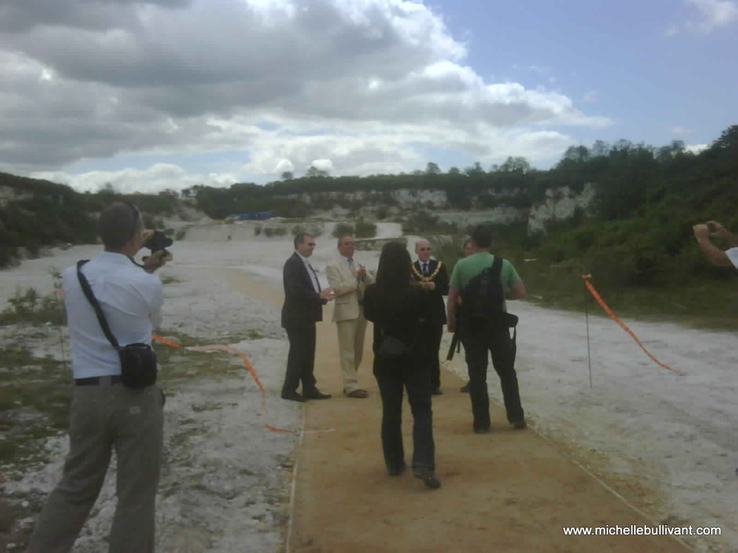
Open Day at East Pit, Cherry Hinton chalk pits 2010
Since the Wildlife Trust has taken over the site it has become a nature reserve and it is open to the public. There are also some display boards at the site for you to read.
As part of the excavation I was commissioned by English Heritage to write a report on the background and history of the site as part of the research into the site and subsequent write up of this new excavation. I took the opportunity to have a picture taken, to use for the cover of my report, with Mark and Richard, that mirrored a photograph of three of the antiquarians from the past, that had had a similar picture taken, it was a proud moment to be following in their footsteps. 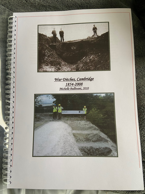
March 2024:
I have attached my report on the War Ditches below and in the downloads section in the main menu. This report is currently undergoing review and preparation for publication. As a temporary measure, it is provided here as a draft PDF for your reference and fair use. I believe it is essential to make such material available rather than risk it never seeing the light of day due to protracted publication processes or ongoing research endeavors, which may continue indefinitely if not managed carefully. Originally authored in 2010, it is high time that the valuable information and research contained within be accessible to others. I intend to update and refine it further before its final publication. I trust you will find it both informative and engaging in the interim.
If you'd like to support the work that I do, why not buy me a coffee, I'd be really grateful and it will help keep me going :)
5 Comments
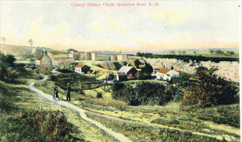 The Cherry Hinton chalk pits are on Lime Kiln Hill at the north western most spur of the Gog Magog Hills. The top of this hill comands impressive views across the town of Cambridge and beyond and as such has been an important site of settlement and defence since prehistoric times, an Iron Age fort known as The War Ditches was discovered on the site in the late 19th century. The quarrying and industrial use of the site has gone on from at least Roman times due to the high quality chalk and clunch (superior chalk). Cherry Hinton clunch was used, during medieval times, in buildings such as Ely Cathedral and the Cambridge Colleges. Quarrying and lime burning at the site continued at the site well into the 20th century.
The Tutton (or Tottenhoe) Way is an ancient route-way that skirts the eastern edge of Cherry Hinton old parish, now Ward, and now also forms the eastern Cambridge City Boundary.
VIDEO 1 of 3 - Tutton Way
The Tutton Way, from the top of the Gog Magogs, on Worts' Causeway, opposite the Shelford Gap, looking down towards Cherry Hinton village and across Cambridge.
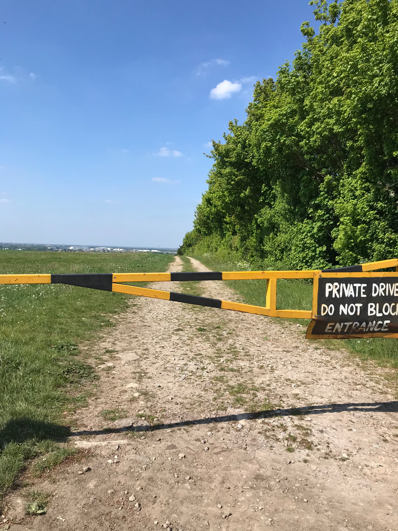
I can, so far, trace this boundary from the northern end of Bridewell Road in Cherry Hinton where it joins Fishers Lane, following through the back gardens and the line of this routeway south, to meet up with the small passage way at the other end of Bridewell Road, that leads through on to the Back Field, where it continues on in the form of a paved footway to join Fulbourn Road. It then crosses straight over Fulbourn Road and enters the northern boundary of the Gog Magog Hills, where it travels up through a field edge as a trackway, going first alongside the eastern edge of the Peterhouse Technology Park and then continues up over the hill, in a straight line, through the fields as a wide trackway (currently closed to the public). The Tottenhow Way then meets the Worts' Causeway Road at one of the highest points on the Gog Magog Hills, where, straight across the road, it continues, for a short way, as a wide trackway named the Shelford Gap before apparently ending at the thick hedge line beyond which the Gog Magog Golf Course lays. It also meets the apparent end of the Roman Road, collectively known as Worstead Street or Wool Street. The Roman Road leads off of the end of the Shelford Gap (Tutton Way) in a south easterly direction, in a long straight line for many miles.
VIDEO 2 of 3 - Tutton Way
At the end of the Shelford Gap, looking north, toward the cars parked on Worts' Causeway. This is really an extension of the Tutton Way and this is the point where the Roman Road leads off to the right.
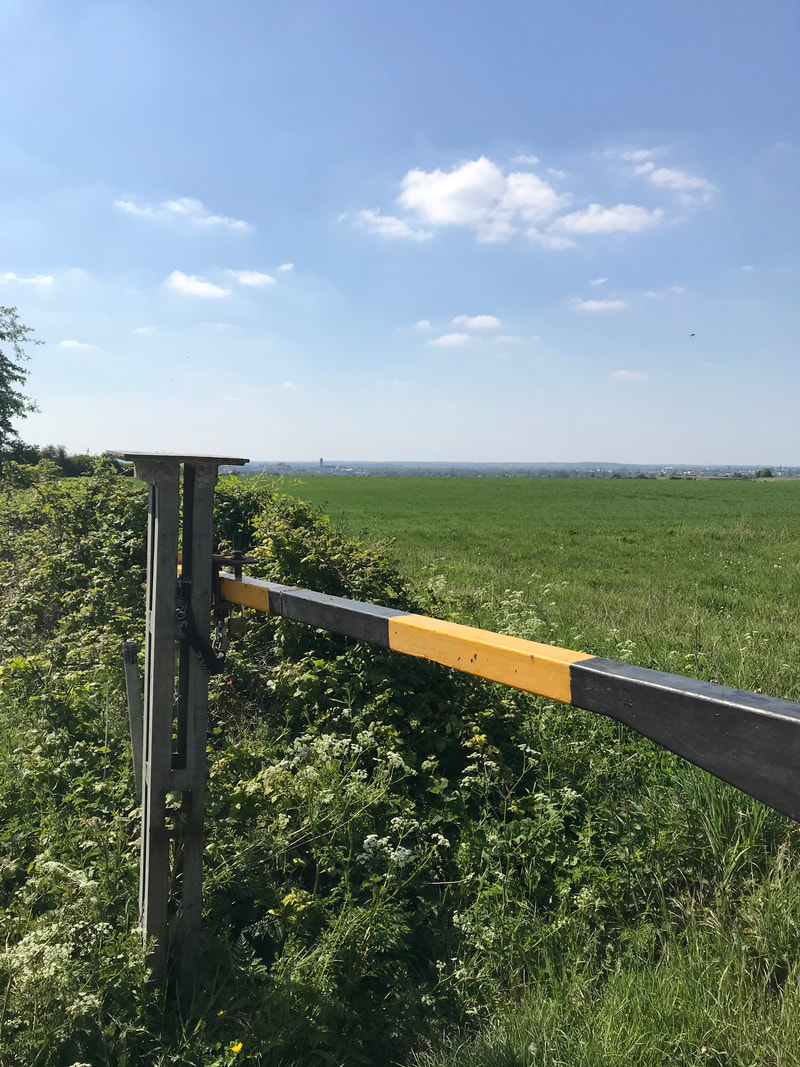
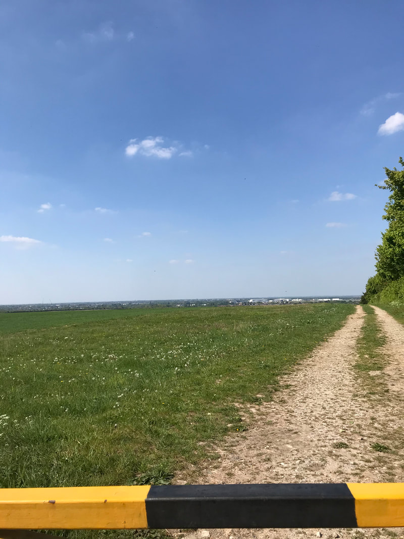
There is a little bit of a dirt track entrance/parking on the roadside by the start of the Shelford Gap on Worts' Causeway and barriers to prevent vehicles driving down the track but it is a popular place to start the walk down the Roman Road. However, it’s not very advisable to go there alone and there are, shall we say, interesting individual and collective, unusual activities that go on at that spot, particularly as there is a small wooded area alongside the trackway. It is not really very safe to walk up to this point as there is no real safe footpath from Cherry Hinton, so going by bike or car is currently the safest way.
From Cherry Hinton the route is taken, starting from the Robinhood at the junction of Cherry Hinton High Street and Cherry Hinton Road. Go straight over onto Queen Edith’s Way. Take the first turn on the left to drive over Lime Kiln Hill, at the immediate base of Lime Kiln Hill, where there is a crossroads. Take the next left to drive up Worts' Causeway, passing the Beech Woods on your right, continue up the hill until you reach the crest, where you will see the parking area for the Shelford Gap on your right hand side. You will be able to cross the road on foot to look north over the Tutton Way and see the spectacular views across Cambridge, Cherry Hinton and beyond. If it is a very clear day you will also be able to spot Ely Cathedral in the distance (about 20 odd miles away.)
Once you’ve finished your visit you can either go back the way you came or you can continue along the road eastwards, turning right, as you come out of the Shelford Gap on to Worts' Causway, where it then becomes Shelford Road. It will lead you over the hills, with lovely views, where you’ll also be able to see the sails of the Fulbourn windmill on your left as you make the descent down towards the village of Fulbourn. At the bottom of the road you’ll meet with Cambridge Road and mini roundabout, where you can turn left and follow the road straight back to the Robin Hood pub in Cherry Hinton.
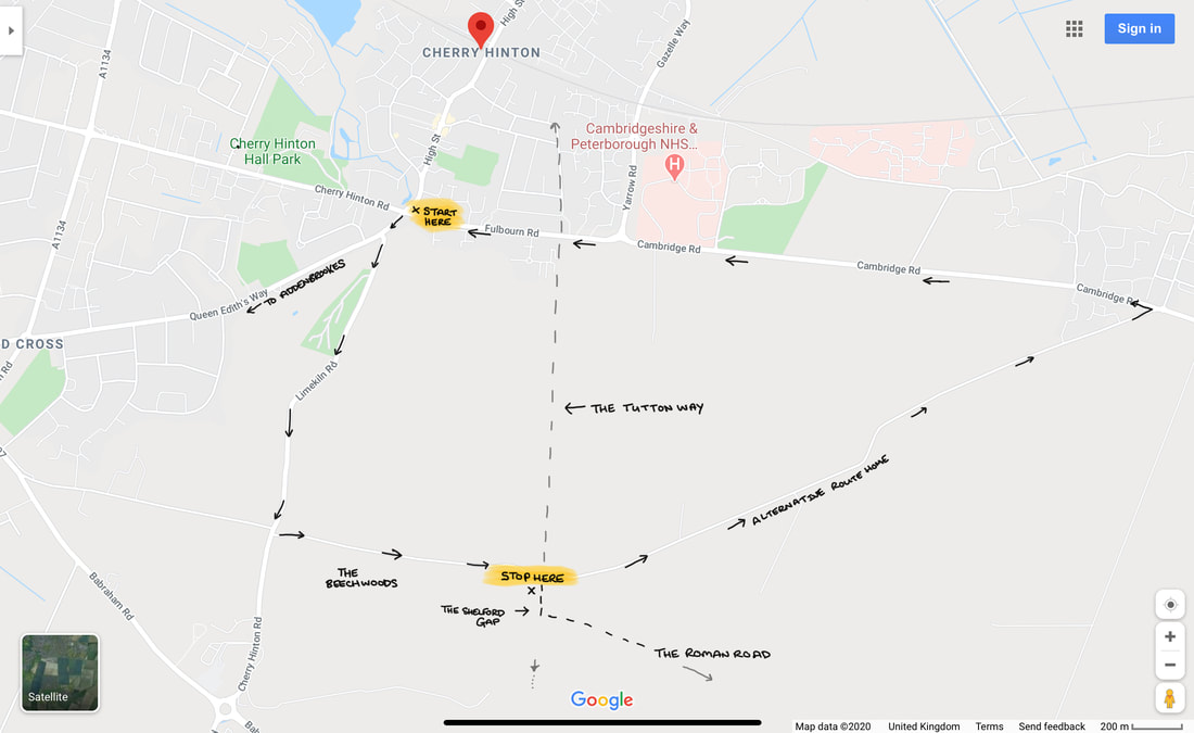
Directions to the Shelford Gap with the route of the Tutton Way, which is now a private road in part.
I think, on the whole, hardly anyone today knows about the existence of the Tutton Way, other than the people who remember me talking about it when giving local history talks to groups, where I would mention it now and then. I had found out about it from reading old documents, maps and surveys from Cherry Hinton when doing my research on the village over the years. Being stuck in isolation during the lockdown is giving me chance to write up a few things that I’ve been meaning to write about for some time, including the ever-allusive Cherry Hinton Local History book that I’ve been promising to write for years. So, I thought I’d start with writing about a few of the places you can walk to or get to, for nice walks and offload some of the information and theories about the archaeology and local history of the area, out of my head and onto paper/screen, with an idea to start forming the book that I must get done.
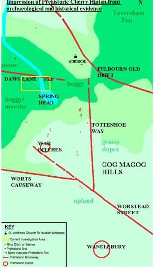
Prehistoric Cherry Hinton Map ©Michelle Bullivant 2010
The map above, that I made some time ago, gives you an idea of some of the routeways and sites in and around Cherry Hinton during prehistoric times. I have placed the current main church building of St Andrew's on the map just to help you get your bearings. You can see the Tutton Way (Tottenhoe Way) that we are discussing, you can also see the Roman Road and the projection of its, potentially earlier route. You can also see the hillforts of Wandlebury and the War Ditches. I also mapped out the (at the time) known burial (barrow) sites, showing their relationship to the routeways. It just gives you a basic illustration of the area that we are looking at and makes the point that you can often tell ancient (pre Roman) boundaries and route-ways as they are often have barrows and other markers along their course.
At the end of the Shelford Gap, near to where it meets the Roman Road, were once two locally known barrows, nicknamed the Two Penny Loaves: "Smith's carrier's cart turned right from Fulbourn, heading south into rolling countryside. All the way it creaked ever upwards, till at the top of a ridge they reached an ancient track which was apparently an old Roman road linking Cambridge with Colchester, the way marked by two barrows, called by local people the "Two penny loaves" (Pickwick's Cambridge Scrapboook 1838, Mike Petty) "At this point, where the road returns to its original direction, there are the remains of two tumuli, called the Two- penny Loaves, one of which was opened in 1778, and seven skeletons were found at its bottom ; six of them were laid close together and parallel, with their heads pointing due north, the other lay with its head directed due west, and its feet next the side of the nearest of the six (Nichols's Lit. Artec, viii. 631)" (Ancient Cambridgeshire, by Charles Babington, Cambridge Antiquarian Society) 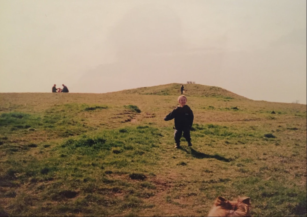
The picture above (with my son in the foreground and daughter climbing in the background, many years ago) gives you an idea of what Bronze Age burials mounds, or barrows as they are also called, look like. The one above is situated on Thurfield Heath in Royston, not that far away. You may often drive past them at the side of roadways and not realise what they are, a good example is of the one on the A11 as you drive towards Norwich from the 5 went ways roundabout at Barton Mills. The Two Penny Loaves would have looked something like this, standing side by side. However their fate, as with many of these barrows, was that they were excavated and destroyed, with the majority of barrows being ploughed away over the years to only occasionally be seen on aerial photographs as a crop mark on the ground. After lockdown, I will see if the Gog Magog Golf Club will let me go and have a look for the site of the Two Penny Loaves and report back to you if any sign of them remains.
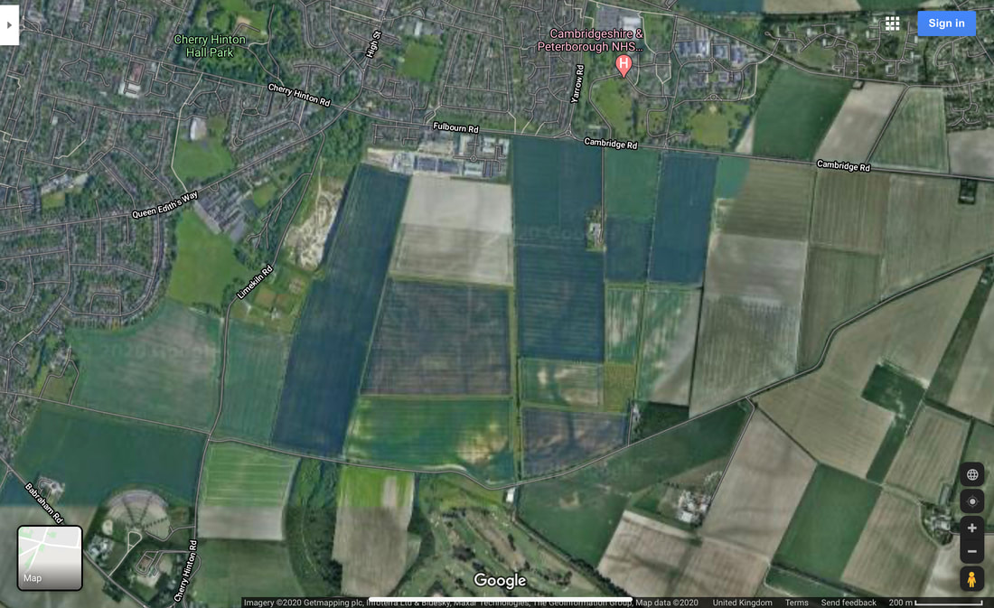
An aerial view of the Tutton Way and Shelford Gap. See if you can follow it's line from Fulbourn Road, where it runs alongside the end of the Peterhouse Technology Park, south to join the Shelford Gap.
One of the earliest descriptions that we have of the layout of some of the land in Cherry Hinton comes from a written survey of the Manor of Netherhall in the Parish of Hynton from 1592 (Separate articles on the Manors of Cherry Hinton and place names in the area soon). Unfortunately this survey, carried out by Christopher Saxton (you can read about him on Wikipeadia), is a written survey only with no accompanying map that we know of. This means we have to go by the written descriptions within the old open fields of the parish to work out where he is talking about.
The main open field that the Tutton Way traversed was called Quarry Field, it was a large area covering across from Lime Kiln Hill, on the Gog Magogs, eastwards to the parish boundary (the Tutton Way). Saxton gives the following description and land measurements:
"Quarry Field... The Furlong abutting the Totton Way - One piece lying in the lands of ..Junior South - 1 acre, 0 roodes, 5 dawks and 3 pches One piece laying between the lands of Uphall on the east and Gilbert Wise on the west - 0 acres, 2 roodes, 8 dawks and 2 pches" (London Metropolitan Archives, H01/ST/E/106/002) So here we see the first known written mention of the Tutton Way - spelt by Saxton, as 'Totton'
The next reference to the Tutton Way can be found in the Survey of St. Thomas' Hospital Land in Cherry Hinton, 1733 by John Tracey. (Survey of Hospital Propery at Cherry Hinton, by John Tracey, 1733. London Metropolitan Archives, H01/ST/E/107/003) which again was a written survey based within the old open fields of the parish but this time, contained three simple maps. One of which shows the route way, within Quarry Field, called Tutton Way. I'll order a decent copy of the map and place here, after lockdown, so you can have a look.
Here you can read a bit more of a very good, general overview about the Roman Road, written by my friend and colleague Tim Malim. You will see that this link takes you to the Friends of The Roman Road & Fleam Dyke website, where you can have a little bit more of a look at their take on the Cambridge Dykes. I will do a separate article or two about these and The Roman Road myself at some point soon because if I start on these now I’ll get completely side tracked and loose my focus on the Tutton Way - research is never really done!
https://frrfd.org.uk/archaeology-and-history/roman-road/
If you want to know a bit more about Wandlebury, for now, you can follow the link below, to take you to the Cambridge Past, Present and Future website, who look after the Wandlebury site.
https://www.cambridgeppf.org/wandlebury-history And more on the War Ditches can be read here, linked from the Wildlife Trust website who now manage and care for this particular site. https://www.wildlifebcn.org/sites/default/files/2018-05/East%20Pit%20Archaeology%20Report_0.pdf Again, I will write something further on both Wandlebury and the War Ditches at some point soon and post here on my website for you but I just need to focus on one thing at a time or I shall be drawn into writing great reams of theories, arguments and never actually getting anything up and published for you.
The earliest maps and surveys, that I’ve mentioned above, call the routeway the Tutton Way or Totten Way, where as I have seen it also named the Tottenhoe Way on a later map. There are a couple of possible meanings to this name – If we start with the earlier ‘Tutton’ it could be a derivative from the word ‘tot’ meaning fool or idiot, perhaps indicating a more perilous routeway – the fools way. Another thought is that ‘toten’ is the German word for ‘dead’, suitable for an ancient routeway lined with the burials of the ancestors perhaps? However, the later used name of 'Tottenhoe' makes a little more sense in many ways, as Totternhoe is a village in central Bedfordshire where the Totternhoe stone is sourced, now bear with me, as this does relate to our site in some regard – Totternhoe stone is not hard stone, it is a seam of very strong, durable chalk which was quarried in that area for use in great buildings, such as Westminster Abbey. Here in Cherry Hinton, from at least the Roman period, the strong building chalk, known as clunch, has been quarried and in turn used in such buildings as Peterhouse College and Ely Cathedral. You can see the evidence of this at East Pit off of Lime Kiln Hill, in the large open quarries there, which is only a stones through from our Tutton Way. Perhaps the name related to this strong chalk and its quarrying industry. Does the chalk seam run from Bedford through Cambridge? Burwell village, to the north east of Cherry Hinton, also used to have chalk quarries where the Burwell Rock would be quarried for building use in similar ways.
A quick google for you, rather than me spending ages going through the piles of old maps that I have here, reveals some further information, from Cambridgeshire Geological Society, which gives this latter theory more credence as being the most likely for the naming of our routeway. http://www.cambsgeology.org/565-2-3-2 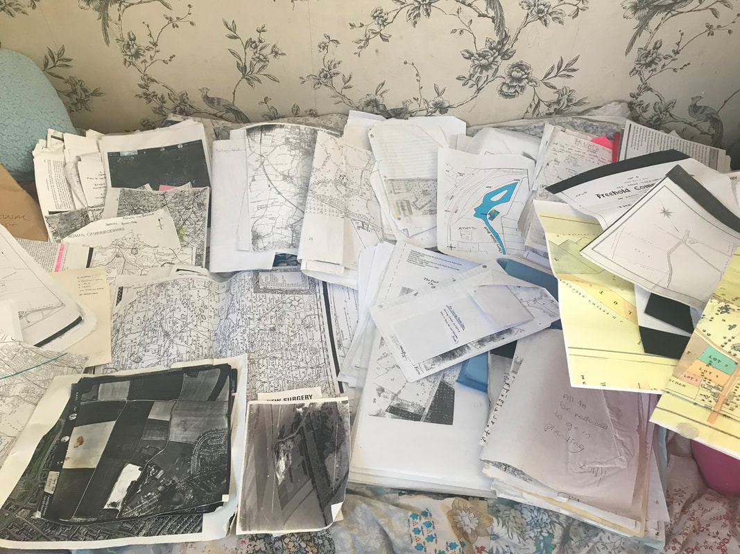
Just a small pile of the old maps, aerial photographs, documents and such like, that I have to organise, all relating to Cherry Hinton and my research.... as I find anything relating to the Tutton Way, I will add it on to this post.
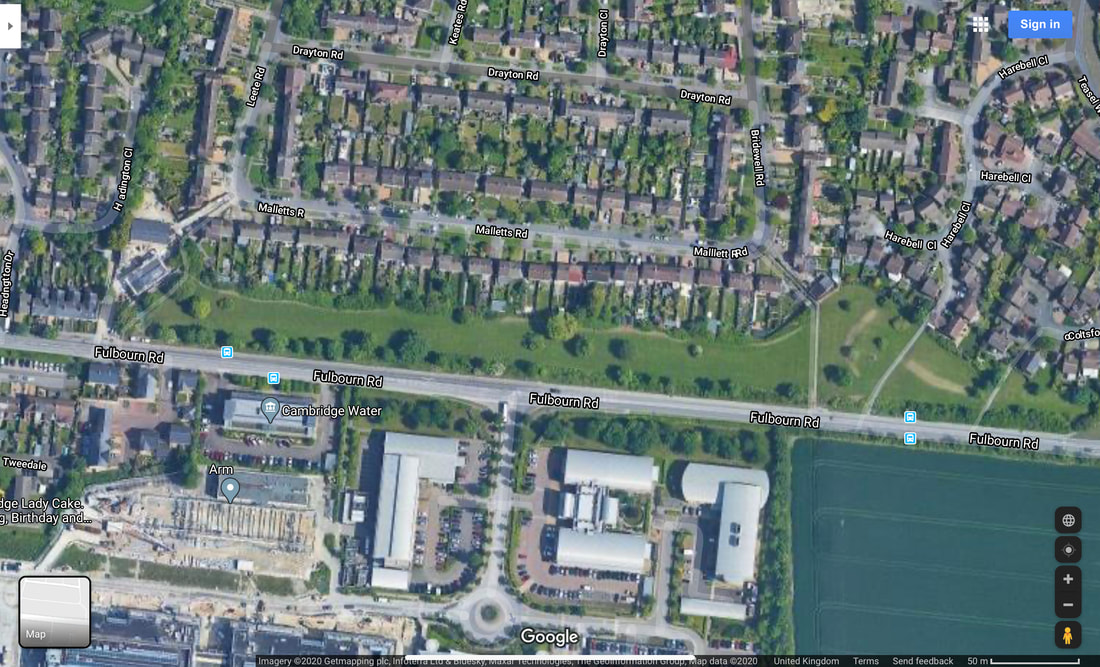
If you go onto the Back Field in Cherry Hinton, at the eastern end where a passageway leads through on to Bridewell Road, you can stand on the Tutton Way as it cuts over the back field in the form of a wide paved pathway, which leads out onto Fulbourn Road. Once out onto Fulbourn Road, you will be able to see that this spot also marks the official Cambridge City Boundary, with a sign, again highlighting the importance of this ancient boundary. The back field is a Cambridge City Council owned green space which local residence use to walk their dogs and the staff, at ARM across the road, come out to have games of cricket and sit and enjoy their lunch. In the autumn there are great amounts of blackberries to be picked and in the spring the boundaries are covered in yellow daffodils. The Back Field runs from the passageway that runs into Leete Road, off of Fulbourn Road and it ends just before the hedges as you approach the roundabout at Yarrow Road, Fulbourn Road junction.
VIDEO 3 of 3 - Tutton Way
Aerial View of the Back Field on Fulbourn Road, with the Tutton Way crossing over it, on the right hand side, in the form of a pathway leading across the road and alongside the Peterhouse Technology Park, continuing up onto the Gogs
The Tutton Way can be seen in the form of an earthwork running along inside the back gardens of the houses on the eastern side of Bridewell Road. My mum used to live down the end section of this road and there was a large, clear slope running up and through her back garden which was not a natural slope but man made.
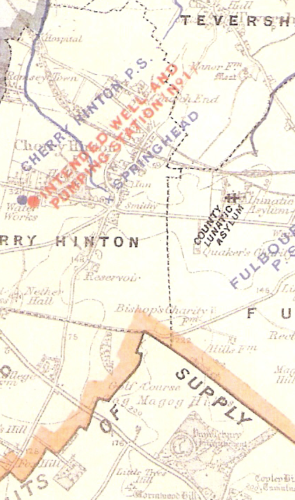
https://cherry-hinton.ccan.co.uk/content/catalogue_item/cambridge-water-works-supply-map-showing-spring-head-cherry-hinton, Cambridge Water Works c.1900
The map above (which you can see in full on the Cherry Hinton Community Archives website), shows the parish boundary marked by a dotted black line. As it stands and from what we (you and I) now know, the Tutton Way ends were it joins the old Roman Road at the end of the Shelford Gap, however, you can also see that if you were to draw a straight line from this point over the Roman Road, that the Tutton Way would lead straight into Wandlebury hill fort. I would strongly suggest that it did just that, once upon a time.
If you then follow the Tutton Way north, across the field and back towards Cherry Hinton village you come to a point where the parish boundary abruptly turns to the right, up and then to the left again, creating a off set square shape. The point at which the boundary turns is where the Tutton Way ends, as far I can tell at this time. This point is at the bottom of what is now Bridewell Road, where it meets Fisher's Lane in Cherry Hinton. The odd square actually marks out where there was once a some common land, it was called Drayton Common. It can easily be imagined that cattle were put out to pasture on the common land at this point and then driven up onto the higher ground, along the Tutton Way, perhaps in even earlier times, all the way into Wandlebury encampment itself. However, more research and on the ground field work is needed to really test out and explore if this really was the extent of the Tutton Way. It good fun to get out the maps and look on aerial views of the site and see if we can look for clues and trace the line of this old route way any further - perhaps the route continued across Drayton Common to meet at the crossroads by the church, with what is now Church Lane, the High Street and Fulbourn Old Drift? Or did the route turn at some point and join Daws Lane which runs bend Cherry Hinton Hall and was one of the old route-ways into Cambridge? etc. etc..
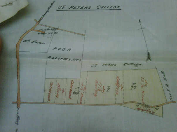
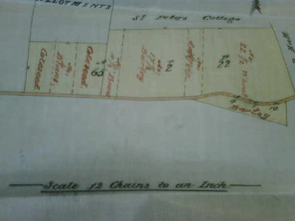
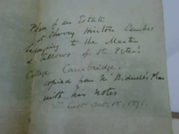
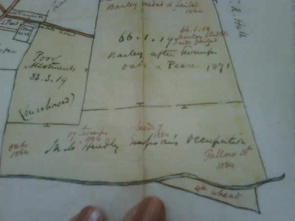
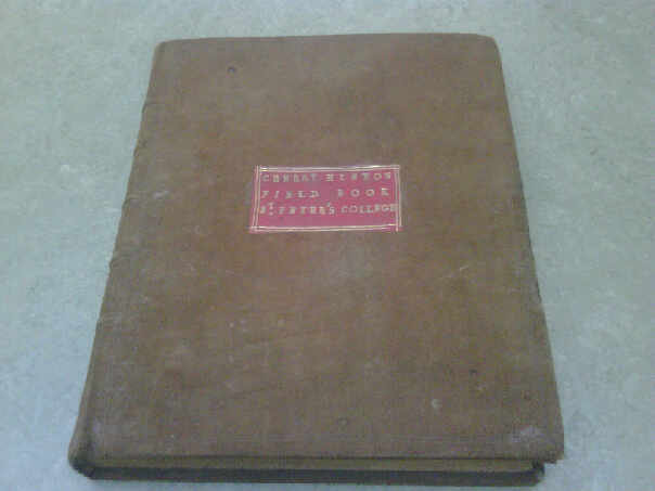
Below are a selection of photographs that I took of some of the records held by Peterhouse College, who owned a lot of land in Cherry Hinton. I am afraid that the pictures rea not very good quality as they were taken some years ago on an old phone or camera, so I must get back to Peterhouse to get clearer images. The pictures below cover the area around the Shelford Gap and are from the 1870's, recording what crops were grown and if they were successful etc. The important thing of note is that within the written columns Quarry Field is mentioned along with "Furlong abutting the Totten Way" - so the name was still in use for this route way around this date.
As always, research is never finished and theories evolve as more data becomes available but they must all start somewhere - an idea, a clue and most importantly curiosity. I will add to this and any other of my posts as and when I discover some new piece of information to add, in the meantime I hope this has been of some interest to you all :)
If you'd like to support the work that I do, why not buy me a coffee, I'd be really grateful and it will help keep me going :)
|
|||