|
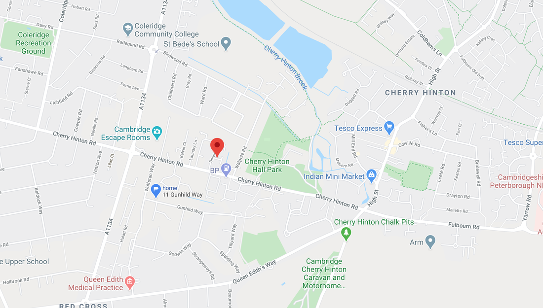
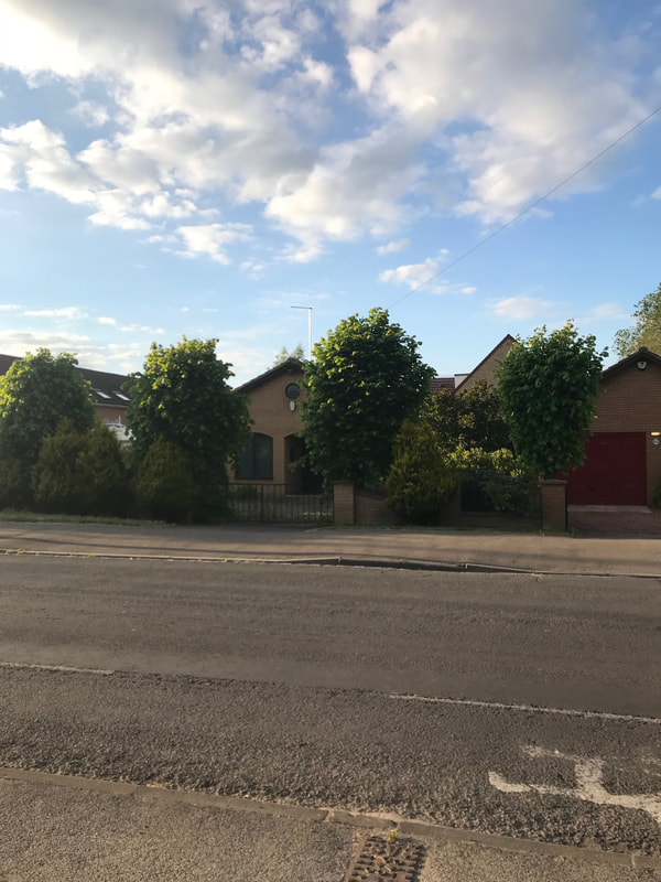
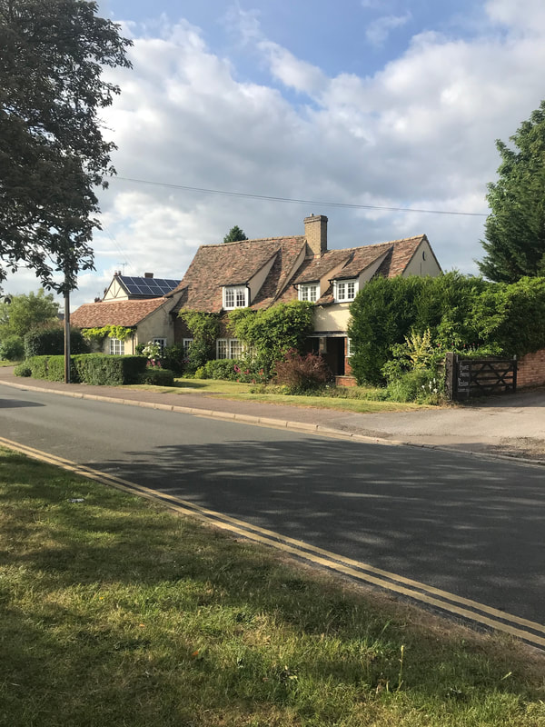
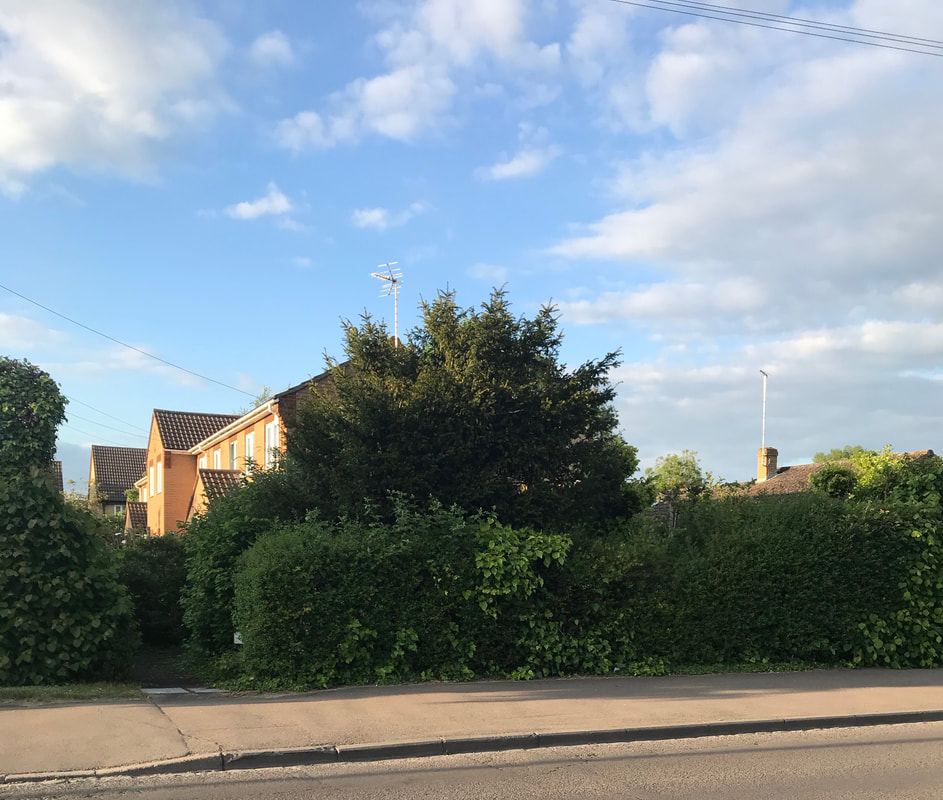
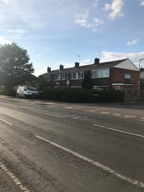
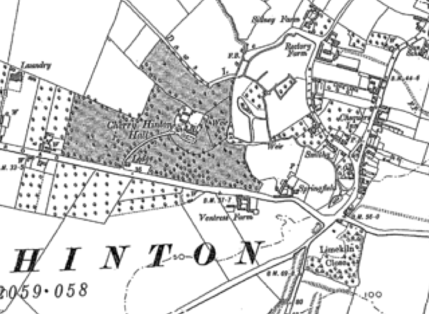
Lime Tree Farm stood on the northern side of Cherry Hinton Road, more or less opposite where the Army Reserve Centre and BP garage are today, on the other side of the road, a little to the west of Cherry Hinton Hall. The Coe family lived there for over a hundred years, originally market gardeners, growing produce on the surrounding land and fields, by the 1950's a tea room and small shop had opened at the farmhouse run by Mrs Elsie Coe, eventually becoming a small independent shop run by her daughter-in-law Mrs Eileen Coe in the 1980's, after the market gardening had ceased. In the 1990's Mr Cyril Coe and Mrs Eileen Coe sold off the remaining farm surrounding the main house, where the modern Coe's Court was built. They then had a bungalow built on the site, facing Cherry Hinton Road, for themselves - the old house eventually being demolished, as the new development continued. Mr Cyril Coe died in 2006 and Mrs Eileen Coe died in 2009. This ended the Coe family line at the site of the what was Lime Tree Farm. The old pollarded lime trees along the front of the site still remain today, and many people who have lived in the area still remember visiting the little shop that was once so popular.
Location:
We can look at what we know of this area, before Lime Tree Farm came in to existence but it would seem that we are looking at the creating of the site as a farm being in the mid 1800’s.
Before Enclosure took place in Cherry Hinton, in 1806 - which ended the old, medieval open field system and divided the land up into different parcels and shapes, with new landowners coming in, some roads altered and new ones laid out - the site where Lime Tree Farm stood would have been quite marshy here and there, as it lay on the lower, flat land, which until the mid-late 1800’s was not fully drained. It is unlikely that there was anything built on this site before Enclosure. Within the open field system, the site lay within one of the large open fields of Cherry Hinton, called Bridge Field. From the two older surveys that we have of the parish, prior to Enclosure there is no mention of a farm within Bridge Field. (Saxton survey 1592 & Tracey survey 1733). As is the case with the pre- Enclosure and Enclosure maps c.1806, there is no noting of any building upon the plot that was later to become Lime Tree Farm.
It is likely, that with the opportunities presented by the new divisions and alterations of the land around the parish, when Enclosure took place in 1806, that the land required for the farm was purchased and arranged around that time. Then, with all the new improvements, including the laying out of public drains and roadways, it gave the perfect situation for a new building site and positioning of a farm. Cherry Hinton Road had not existed before Enclosure - instead there was a route, slightly off course of the modern road now, called Long Drove, that only ran a short way from the Robin Hood crossroads into what are now the grounds of Cherry Hinton Hall, presumably because the fields beyond, towards Cambridge (Hill’s Road), were so prone to flooding. As we can see by what Vancouver wrote about this area of Cherry Hinton in 1794:
‘There is a moor of considerable extent lying between the highlands of Cherry Hinton and Barnwell on the north east and at Trumpington and Cambridge on the south west, which at this time is greatly annoyed by the stream which passes through the west end of Cherry Hinton. This moor is sacrificed to the constant height of water in this brook.’ At Enclosure, a plough was employed to drive a straight furrow all the way along from Fulbourn to what is now Hills Road, to create Cambridge Road - now called, Cherry Hinton Road. The main routes in to Cambridge, pre 1806, were over Lime Kiln Kiln to the Three Hills Way (that led into what is now known as Hills Road and then on into Cambridge) or down Daws Lane, an ancient route-way, now a footpath, laying behind Cherry Hinton Hall, along with other seasonal footpaths and route-ways that traversed through the centre and north of Cherry Hinton.
The earliest mention that I can find of the Coe family, living within Cherry Hinton, on the Parish records is dated 27th November 1782 when William, son of Richard & Mary Coe is born.
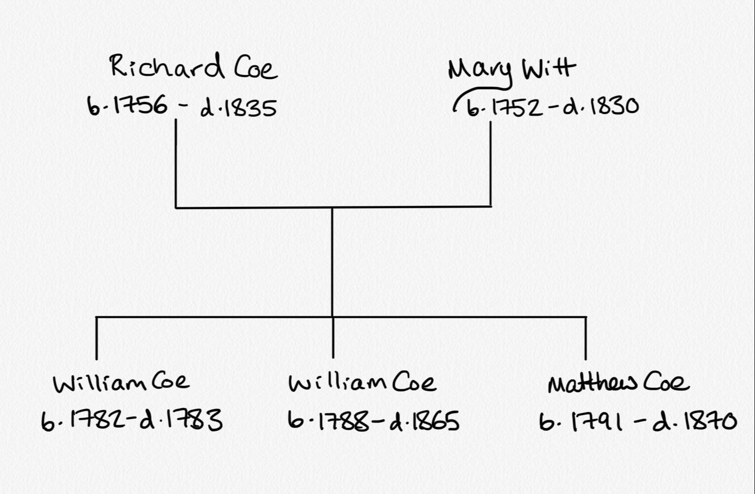
From the family tree research that I've just carried out on the Coe family, Richard Coe was born in 1756 and died in 1835 (79 years old). He was married to Mary (nee Witt) born 1752, died 1830 (aged 78). They had the following children:
William 1782-1783 - died aged c.1 year old, William 1788-1865 - died aged 77 years old, Matthew 1791-1870 - died aged 79 years old.
The following articles appeared in the Cambridge newspaper relating to Richard Coe of Cherry Hinton, the same Richard Coe as mentioned above:
3rd November 1815 (Cherry Hinton Chronicle, E.Filby)
“On Monday past, Issac Henly and James Howe were committed to the County Gaol, by John C. Mortlock Esq., charged on the oath of Richard Coe of Cherry Hinton, with having on Saturday last broken open his dwelling-house, in the day-time, no person being therein, and feloniously stealing taking and carrying away various articles of wearing apparel and working tools, his property.”
March 3rd 1816 (Cherry Hinton Chronicle, E.Filby)
“Cambs Assizes: On Friday last the 15th. Isaac Henly and James Howe, for feloniously breaking open the house of Richard Coe, of Cherry Hinton, in October last, and stealing some wearing apparel and other articles besides, were each sentenced to be imprisoned six months, and to be privately whipped.”
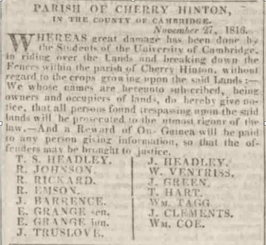
We then find reference to William Coe, Richard's son in the newspaper article below, stating that he is an owner and occupiers of lands - in the parish. He is amongst the owner/occupiers who had larger areas of land in the parish to manage, indicating that William is in some form of farming.
6th Dec 1816 (Cambridge Chronicle, British Newspaper Archive -BNA)
By 1841, On the 1841 Census for Cherry Hinton, we can see that there are three separate Coe households:
Matthew Coe, aged 45, gardener, with his wife Mary aged 40 and their children; Barron aged 19, James Barro aged 17, Joseph aged 15, Sarah Ann aged 13, Jesse aged 11, Emily aged 9, Charles aged 7, George aged 5, Jane aged 3. William Coe, aged 26, gardener, with his wife Charlotte aged 26 and their children; Gabriel aged 7, Arthur aged 5, Walter aged 4, Sarah aged 2, n-k aged 3. William Coe, aged 50, gardener, no wife so presumably widowed, and his children; Charles aged 22, Frederic aged 20, Martha aged 15, Benjamin aged 13, Naomi aged 8, Issac aged 6.
So there is William senior, aged 50, mentioned in the previous newspaper report. William junior aged 26 above is his son. Matthew aged 45 above, is William seniors brother/William juniors uncle. They have all stated their occupation as 'gardeners', this shows that they were in the business of market gardening, and probably orchard managing by this date within the village. It is tempting to start wondering how many of their orchard trees were from the old cherry tree stock which had given Hinton its prefix of Cherry by the 1500's - it certainly leads to the thought that the village may have been a place of orchards for many generations of villagers. They could have started working the pre-existing orchards but of course, they may have started afresh.
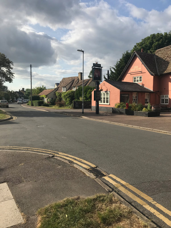
In 1850, we then find Charles Coe occupying property in the village, in Mill End, almost opposite the Red Lion pub in Mill End Lane. The property has an orchard, this may or may not indicate the form of faming that the Coe family were to specialise and expand into, soon after with their own farm, with the creation of Lime Tree Farm. This is the Charles, mentioned on the 1841 census, aged 22, son of William Coe snr. This Charles would now be about 31 years old in 1850.
23rd March 1850 (Cambridge General Advertiser, BNA)
Interestingly, next door to the Red Lion pub in Mill End remains one of the very old cottages of Cherry Hinton and it is named 'Orchard House'. This may be because it had views to the orchards around it or just coincidental but it is still worth a consideration.
In trying to trace the branch of the family that went from gardeners in the village to owning Lime Tree Farm, it is worth looking at each of the family lines in the village, mentioned so far.
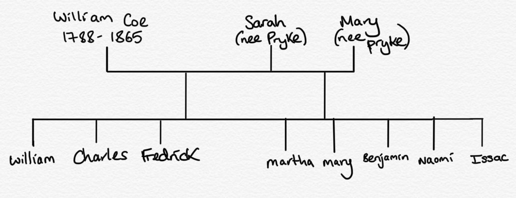
Richard Coe, the first Coe that we see in the village died in 1830 - before the census records began - leaving his surviving sons, William and Matthew, with their family branches in the village. I have been researching their tree and have the following information so far... Starting with the first son, William Coe:
William Coe, 1788-1865 (died aged 87 years old), gardener, he first married Sarah ?-1822 (nee Pryke) in 1813 and after she had died he married, in 1825, Mary (nee Pryke) 1804-1837 (died 33 years old)- probably her sister.
His children with Sarah were: William 1814-1876 (died aged 62), married Charlotte (nee Missen) in 1834. They had several children including; Gabrielle, Arthur, Walter, Sarah, Mary, Ann, William, Jane and Frederick. They are shown as living on the High Street, next to the Red Lion pub on Mill End Cherry Hinton from 1851-1871 where William is listed as a gardener. The listings suggest that they are somewhere to the east of the Red Lion, where William's cousin Joseph (Matthew Coe's son) is living. This could be to the back area of the Red Lion on the High Street, where the post office area is today or on the other side of the road somewhere [edit: could be the cottages mentioned later in this article that lay opposite where the Post Office is today on the High Street - even possibly Apple Wood Cottage, which still remains today]. By 1881, William has died and his widow, Charlotte, is listed on the census as being a greengrocer, living in the next household from George Coe (Matthew Coe's son and her nephew) who was running Lime Tree Farm. So after William's death, Charlotte, along with her daughter Ann, goes to live and work, on or next to, the site that became Lime Tree Farm, on Cambridge Road (now Cherry Hinton Road). Charles 1818-1873 (died aged 55). Charles married Ann (nee Sizer). In 1851 he is listed as a gardener in Cherry Hinton. In 1861, again listed as a gardener, it is shown that he is living with his wife and children in Mill End Road - so as you can see this now tally's with the 1850 newspaper report shown above. By 1871, they are living in Russell Court, Cambridge, where he is still listed as a gardener. He had several children, including Elijah, Ann, Charles, William, Sarah and Jonah. Frederick 1821-1867 (died aged 46) - Frederick is shown working as a gardener at Hinton Cottage in Cambridge. In 1851 he then marries in 1855 Sarah (nee Beales) and they live in Cherry Hinton. In 1861 he is shown as a farmer/gardener employing 2 men and living, with his wife, on the Fulbourn Road to Cambridge. (* Cherry Hinton Road, as it is today, is referred to most often as Cambridge Road, also Fulbourn Road in the older census) They have 2 servants, one a farm servant and one a house maid. They do not have any children. [edit: if you scroll down to the 1883 map below, you'll see a building named Hinton Cottage, this is where Frederick and his family were living in 1851 until his death. It is just to the west of what became the Lime Tree Farm site and the next house along from Provident Cottage, occupied by Mrs Coe]. His children with Mary were: Martha 1825-1898 (died aged 74) - Martha married James Morley in 1853 and they both moved to 63 East Road in Cambridge, where they remained until their deaths. James was a shoe maker and Martha a Laundress. They have no children. Mary 1836-1868 (died aged 42). In 1844 Mary marries James Banyard, an agricultural labourer, they have several children and in 1851 are shown as living in Barron Lane (now gone) in Cherry Hinton. Benjamin 1828-1869 (died aged 41) Benjamin does not marry or have children - you can read more about Benjamin's tragic death below. Naomi 1833-1877 (died aged 44) - Naomi married Joseph Darley and agricultural labourer. In 1861 they are living in the High Street. Then her husband Joseph is listed as a widow in 1881, living in Fishers Lane. By 1891 he is living in the Almshouses (which are opposite the Red Lion pub in Mill End). They do not have children. Issac 1835-1855 (aged 18).
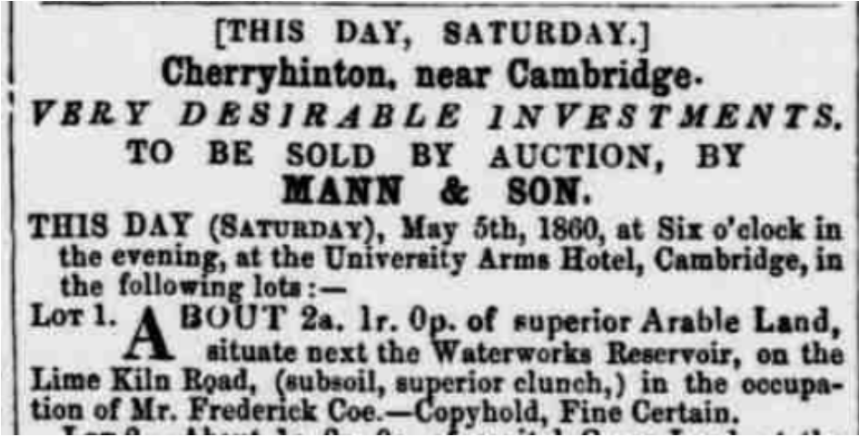
In 1860, we find reference to Frederick Coe, mentioned above, who is working the land on Lime Kiln Hill, this could have been general arable farming or even orchard farming but it could be that he was running a lime pit or chalk extraction enterprise as these pits were on Lime Kiln Hill and very popular at this time.
5th May 1860 (Cambridge Independent Press, BNA)
However, we now know that Frederick was listed as a gardener at this time (1860/1861), so managing the orchards which were on Lime Kiln Hill at the time is most likely.
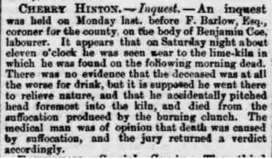
Then in 1869, comes the tragic news of the death of his brother Benjamin Coe:
20th November 1869 (Cambridge Independent Press, BNA)
It is worth noting that on the 1861 census, prior to Benjamin's death, he was also listed as a gardener and no mention at that point of him working at the lime pits, which puts me back to wondering if he and his brother Frederick did indeed manage or own one themselves. However, although Benjamin is found dead in one of the lime pits, it was not an accident whilst at work, as it states he was 'reliving nature' on a Saturday night, not that he worked at the lime pits.
Ultimately this brings an end to William Coe's family line for being the ones running what was to become Lime Tree Farm on Cherry Hinton Road. To find out which Coe line did manage the farm, we must now turn to his brother Matthew Coe, to see what happened with his branch of the family.
The question is, with so many of them being listed as gardeners - how many of them were actually working on Lime Tree Farm whilst living in the village - it is certainly a family occupation. How many of them held orchards or market gardens elsewhere or independently?
The second son, Matthew Coe:
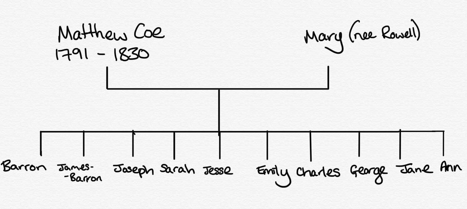
Matthew Coe, 1791-1870 (died 79 years old), gardener, he married Mary (nee Barron) in 1820. In 1841 Matthew is listed as a gardener in Cherry Hinton but then in 1851 we find Matthew is listed as living on Cambridge Road (now Cherry Hinton Road) and that he is a gardener of 9 acres! Add to this that the next property along on the census is Park Gate House - which is the lodge house to Cherry Hinton Hall, which was next to Lime Tree Farm - now means that we have our first clear piece of evidence that the site of Lime Tree Farm was in existence by 1851 and in the occupation of Matthew Coe! (*The farm may have been called something else or just Coe's farm, or could have been named Lime Tree Farm from the start but the earliest documentary evidence of the name Lime Tree Farm, the I have so far, isn't seen until 1901).
Matthew's children with Mary were: Barron 1822-1865 (aged 43). Barron married, in 1843, Maria (nee Rowell) and had several children including: Maria, Mary Ann, Jesse, Matthew, Barron and James. In 1851, they were living on Ely Road in Chesterton, Cambridge, where Barron was listed as being a gardener. By 1861, Barron and his family have moved back to Cherry Hinton and are living on the High Street where he is still listed as a gardener. James Barron 1821-1913 (92 years old). James married, in 1860, Mary Ann Darby. Mary is a laundress. They had several children including Alfred, Daniel (who was also a gardener), Naomi, Lilly, Florence and George. They lived on Fishers Lane for most of their married life, where James is listed as a market gardener, before retiring to their son Alfred's house in Romsey, Cambridge. Joseph 1826-1898 (aged 72) marries Susan (nee Fuller) and they have several children including: Harry, Issac, Levi, Rebecca, Joseph, Matilda and Josiah. In 1851 Joseph is a publican and gardener living and running the Red Lion pub in Mill End, Cherry Hinton. 1861 he is just listed as publican, no longer gardener and is still running the Red Lion pub in Mill End. By 1871 they are living on the High Street and he is a bricklayers labourer, in 1881, still living on the High Street, he is working as a railway labourer. They end up, by 1891, living at Cyprus Place, Cambridge, where he is then listed as a bricklayers labourer. Sarah 1827-1912 (aged 85) married James Smethers in 1849. They have several children including; Matthew, Emily, John, James, Fanny and William. Her husband James is an Iron Founder. In 1851 the are living in Cherry Hinton in Grove Cottage on Ford Way (which I believe to be Daws Lane, through my other research). In 1861 they have moved to Shoreditch, London and then on to Liverpool Street, London. After James dies, Sarah remarries Robert Blinco, who is a Shepherd. They live in Swaffham Bulbeck, where Sarah remains until her death. Jesse 1830-1909 (aged 79) married, in 1852, Delilah Cornwall. They have several children including; Eliza Ann, Arthur Cornwell and George. By 1881, they are living in Hay Street, Fulbourn where Jessie is working as a railway plate layer. By 1891 they had moved to Marmora Road, Cambridge where Jessie continued to work on the railways. Emily 1832-1903 (aged 71) married Charles Short, a stone mason and they have several children. They move a lot presumably to do with her husbands job. They go from Hawkhurst, Kent in 1861 to 6, Liverpool Street in London in 1871, then on to Cheetham, Manchester by 1891, before ending up in Bootham, York. Charles 1833-1913 (aged 80) married Elizabeth and in 1861 they were living in Fisher's Lane, Cherry Hinton, where he was listed as a gardeners labourer. By 1871 they had moved to Teversham High Street, where he was still listed as a gardener. They had several children, including: Alfred, Ellen, Herbert, Zellah, Bertha, Mary Ann, Jane and Charles. By 1881 they were living in Bull's Row, Cambridge and Charles had become a railway labourer. From 1891 until his death in 1911 Charles lived at 36 Cockburn Street, where he was a railway labourer until 1901 when he lists as a bricklaying labourer. George 1837-1919 (aged 92) - George married Elizabeth Mary and they had several children including: Jesse, Herbert Matthew and Lizzie Grace. George was the son which took on the farm (site of Lime Tree Farm) on Cambridge Road, from his father Matthew. In 1871 he is listed as living on Cambridge Road (now Cherry Hinton Road) as a Market Gardener and Farmer, farming 15 acres with 3 farmers employed. He is still there in 1881, 1891, 1901 and 1911 with his wife and all at the same place, with the sons Jesse and Herbert listed as Market Gardeners too. See more on George in the below sections. It always starts to get more challenging when they name their children after other family members :) Jane 1838-1849 (aged 11). Ann 1841-1841.
I hope some of you are still with me on this... I write out as I go, to get my notes and research somewhat organised, discovering things along the way and trying to make sure I get some sort of coherent order for myself should I come back to do more delving at some point. With any luck it will be of some interest to you readers out there too.
To recap so far:
Richard Coe comes to Cherry Hinton (no records found yet of his being born here) he marries Mary Witt, a Cherry Hinton girl. They settled down in Cherry Hinton and have three children. William, their first child dies as a baby. They go on to have at least two more children - William and Matthew. Richard's son William marries twice and has several children, some stay in the village others move away and some die young. William is listed as a gardener. Richard's other son Matthew, also listed as a gardener, marries Mary Barron and has several children, again some stay in the village and some move away but his son Matthew is the first known occupier of the site that was to become Lime Tree Farm from at least 1851. Matthew's son George then takes over the running of the farm as a market gardener and lives there, until his death in 1919.
Market Gardening was a style of farming fruit and vegetable produce, sometimes also flowers, as apposed to general agricultural or dairy farming. you can read a little about it here: History of Market Gardening.
The produce was sold direct to customers, markets and restaurants. With the creation of Cambridge Road (now Cherry Hinton Road) after Enclosure in the early 1800's, the positioning of a Market Garden Farm on this road would have been most convenient to access, not only the Cambridge town market and retailers, but also Cambridge train station (and for a short while Cherry Hinton train station, when it was open) to carry produce to the London markets and retailers.
We will now start looking at Matthew's son, George Coe 1837-1919, to see what becomes of Lime Tree Farm and who next takes it over. Along the way, still including a few local articles about the Cherry Hinton branches of the Coe family.
This next newspaper entry in 1878, refers to Matthew's son George Coe....well... hmm :)
6th April 1878 (Cambridge Independent Press, BNA)
As stated previously, George Coe married Elizabeth Mary Veil and they had three children, Jesse, Herbert Matthew and Lizzie Grace. George was the son which took on Lime Tree Farm from his father Matthew. Of George's children, it is Jesse and Herbert who are still living at the farm and listed as Market Gardeners in 1911.
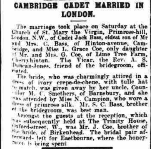
The daughter, Lilly Grace marries first Jack Bass who dies in WWI 16 Aug 1918 in France and Flanders. A good while later, she remarries to Walter Kester and they go on to live in Hills Road, Cambridge. We'll look at Jesse and Herbert Matthew next to see which one takes on the farm, after George's death. But before that, a bit of a catch up on other Cherry Hinton based Coe family news to bring us up to date to Jesse and Herbert.
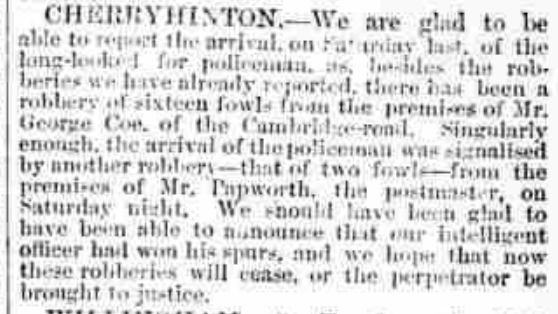
In 1880, we find a newspaper article describing the robbery of fowls from Mr George Coe's premises (Lime Tree Farm).
October 16th 1880 (Cambridge Independent Press, BNP)
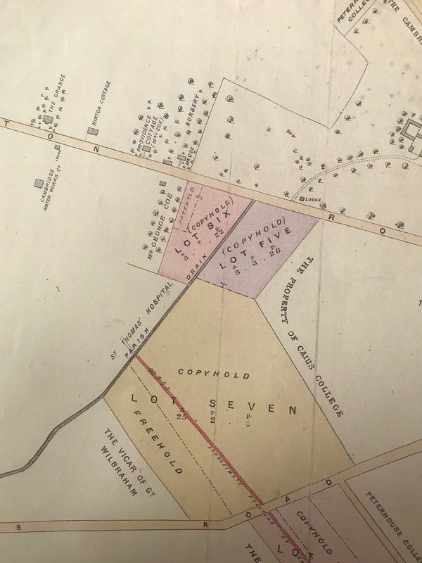
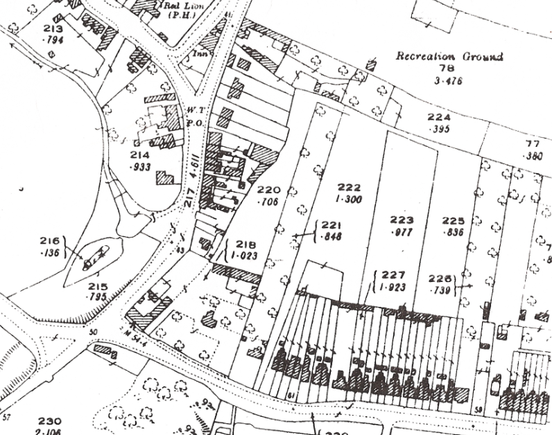
The earliest map, showing the site of Lime Tree Farm, that I currently have, is from some sale particulars of land that is being sold, in Cherry Hinton, by the trustees under the will of John Okes, Esq. - John Okes was the owner of Cherry Hinton Hall, the Hall was built in the 1830's, after John Okes had taken advantage of the land sales post Enclosure. He died in 1871 and most of his land then went into the hands of Cambridge University and Town Waterworks Company (which his brother Richard Okes was part of). John Okes had previously purchased the land needed for the building and laying out of Cherry Hinton Hall, along with a good amount of other plots within the parish. (I will do a separate blog on John Okes and Cherry Hinton Hall, I am also writing the History of Cherry Hinton Hall which will be published in book form shortly.) After his death, many of these plots were put up for sale, as you can see from the map below, on the coloured and numbered lots. The advantage to this is that we now have a good picture of the Lime Tree Farm site.
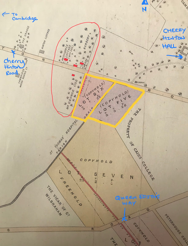
Below, I have placed the same map again, with some annotations, so it is easier to see what and where we are talking about. The area circled in red is in the Coe family land and property. At this point, 1883, you can see the site of what is to be called Lime Tree Farm. The earliest reference that I have found, naming the site Lime Tree Farm is on the 1901 OS map. I've marked the Coe farm buildings in red. In 1883, we can see that there are three buildings on the northern side of Cherry Hinton Road and one on the southern side. Bearing in mind the purpose for which this map was produced - to show sale plots, always be cautious and remember that not all detail is always shown. However, that said, this map does give a fairly good picture and we can clearly see the extent of the Coe's nurseries and orchards at this point, marked on the map by name and the tree pattern.
If you look at the building on the southern side of the road, marked Mr George Coe. You will see that the trees within this plot are marked as being much more uniform in their layout to those across the road. This would suggest to me that this is a more recent plot or orchard trees, than that of those over the road. It is a deliberately laid out orchard, where as trees on the northern plots are a little more scattered. As for the 4 buildings in total, this is interesting because, as many of us locals may remember, from the time Mr & Mrs Coe (Cyril & Eileen) had their shop at Lime Tree Farm, there was one house and some barns out the back. So this begs the question, which one of these buildings remained as the main Coe family house, the one many of us had been in to buy things from, in living memory. We can not be totally sure which of these four building shown were occupied as dwellings by the Coe family or which may have been farm workers cottages or even which may have been large barns. We can see that there is a building named Providence Cottage and marked as though Mrs Coe owns/lives there. Next to that, abutting the main road is another building unnamed and then follows a third building marked Mr Coe. The main nursery, which became Lime Tree Farm lays out the back of these buildings. Over the road, we have the more formal orchard lay out belonging to Mr George Coe and an unnamed building. (Edit: now known that Fredrick Coe lived with his family, from at least 1851 to his death in 1867, at Hinton Cottage, the next house along to the left from Provident Cottage, shown below. Hinton Cottage stood between Laundry Lane and Derwent Close, on Cherry Hinton Road, where there are now a set of 20th century houses).
Remember that Matthew Coe had been first on this site, on the northern side of Cherry Hinton Road, from at least 1851. Matthew Coe dies in 1870, leaving his son George managing the whole operation. So when we look at this map in 1883, what we are seeing is a site managed by George Coe.
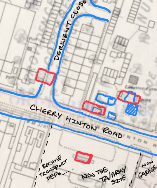
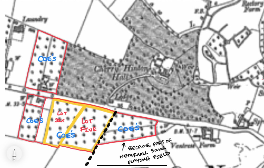
Take note of the the two lots, 5 & 6, which are to be sold and which I have marked in yellow. We will come back to those shortly. First of all, I'd like to just place those 4 buildings, which I have marked in red above, on a modern map to see which one became the Lime Tree Farm house that many of us knew before it was pulled down about 15 years or so, ago.
I have marked the same red buildings that I marked on the 1883 map above, again marked in red on the overlaid 1970's OS map (blue buildings are some of the 1970's buildings) to see roughly where they once stood.
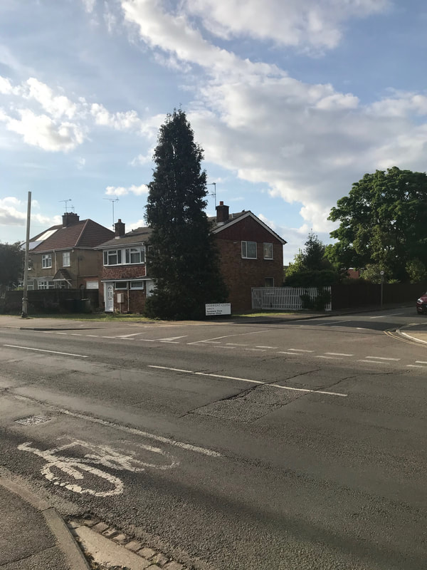
Providence Cottage, which was shown as in occupation of Mrs Coe in 1883, top left of the picture, was demolished when the Derwent Close estate was built c.1960's. any remains are now beneath the road and in the gardens of the houses that now stand there.
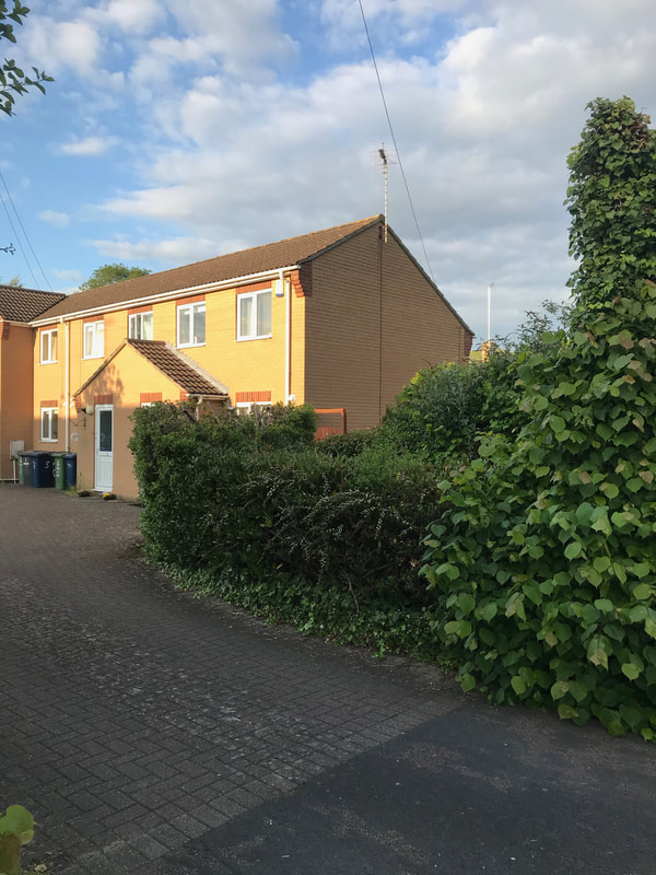
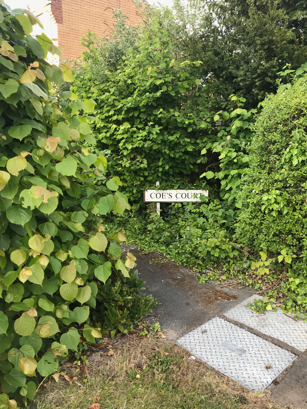
The next red building along, moving right on the picture, is again beneath more housing. Now Coe's Court.
Coe's Court, where the second red building stood (barns):
The top right red building, which was marked Mr Coe on the 1883 map, has the building, probably extended and altered somewhat, which us locals knew as Mr & Mrs Coe's shop/Lime Tree Farm.
The 4th red building shown on the southern side of Cherry Hinton Road on the 1883 map and marked next to the orchard plot George Coe, became the site of the old transport depo by the 1960's and is today the Army/TA Centre.
So it appears that it is the top right red building, on the 1883 map, that remained the longest and became the main house.
The next thing I'd like to do is have a quick look at the 1881 census for Cherry Hinton again, to see if we can now place who was living where, out of these 4 buildings and if they were all dwelling houses.
There is no one living in the building on the southern side of the road - suggesting that it was some kind of large barn perhaps. There are three Coe households on the 1881 census, which we can tentatively say correspond to the three buildings. The first building of Providence Cottage has Fredrick Coe - engine driver, with his wife Mary and their children Frederick, Mable, Alice and Arthur. (*Note that this is not the Frederick who had lived in Hinton Cottage because he died childless in 1867. This is Frederick who's mother is mention next). Next along we have Charlotte Coe (widow) greengrocer, with her daughter Ann and grandchildren Nellie and William Reynolds. - although I'll note here now, that I think that it is quite probably that these two listed households of Fredrick and Charlotte's may well have all been within Providence Cottage and that the second red building along, unnamed were barns or such like (not least because I remember playing in those barns when I was young.) Then on the 1881 census, in the third red building on the northern side of Cherry Hinton Road, to the right on the maps above, marked 'Mr Coe' on the 1883 map, was George Coe, market gardener aged 45 with James Shyles, agricultural labourer and servant. This building being the most likely candidate for the original farm house that George's father, Matthew had occupied.
So back to that sale map of 1883 - do you recall the yellow lined plots 5 & 6 that I said we'd come back to? Have a quick peep at them again and then look at the map below from 1885.
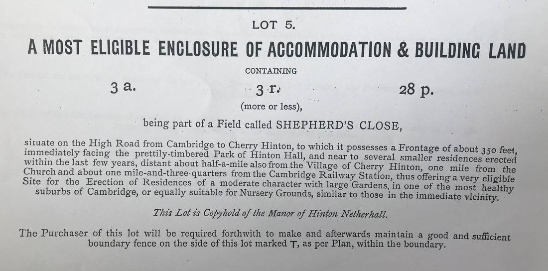
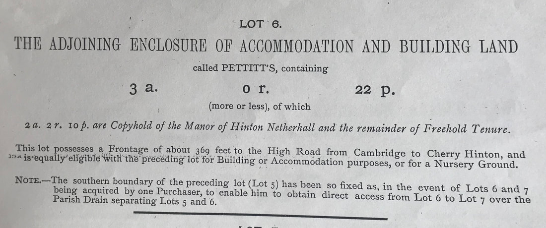
Firstly, here are the two lot descriptions given with the 1883 sale map, for lot 5 & 6.
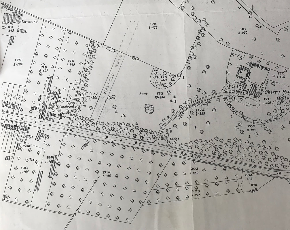
The later OS map of 1885 shows us the site of Lime Tree Farm and the extent of its land and orchards at this date. You will be able to see on the annotated version beneath, that George Coe purchased lots 5 & 6 and even another plot beyond those in a separate sale and turned them all into orchards, as demonstrated by the uniform pattern of trees on the map.
Lot 6 is today where the BP garage is (* as explained in a later blog about Cherry Hinton Hall, the western end of the Hall grounds were sold off in the late 1800's and the Walpole Road estate was eventually built on that patch).
Lot 5 became the Glenmere Close estate. The orchard area to the right, which Coe also purchased (or potentially just rented) became part of Netherhall Lower School front playing field (I can remember playing hockey on that field!). This plot is now under the houses of the Bosworth Road estate.
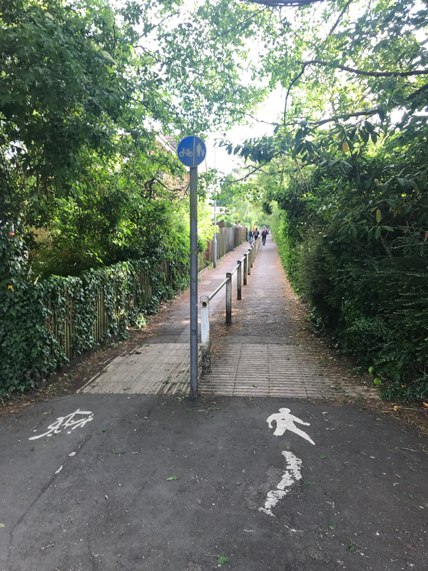
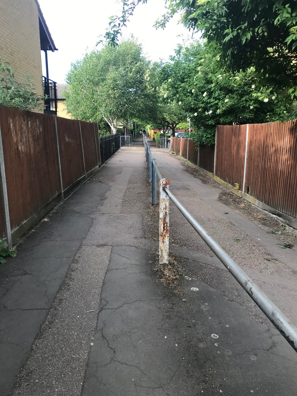
The black dotted line that I have placed on the map above shows, where today, the passageway that leads from Cherry Hinton Road to the gates of what was Netherhall Lower School, now the Queen Emma School, still remains. Many of us locals will remember going through that passage to either get to school or the Netherhall Youth Club building that once stood on the school site. It is still a popular through route for people living on the Gunhild/Queen Edith's sites to get through to Cherry Hinton Hall and generally just a good cut through, when on bike or foot.
The passage-way between Cherry Hinton Road and Queen Emma School/Gunhild Way, running between what was two of Mr Coe's orchards:
Let's continue down the time line, at what event's were recorded.....
In 1894 - we can see that Cherry Hinton had a Cottage Garden Society, in the article below, of which the Coe family were part of:
July 20th 1894
FLOWER SHOW The fifth annual Show of the Cherry Hinton Cottage Garden Society was held yesterday in the grounds of Cherry Hinton Hall. The weather though threatening at first, was very fair. The Cherry Hinton brass Band played a selection of music during the afternoon and evening. The exhibits were arranged very tastefully in a large marquee. Dr Lyon's fuchsias and geraniums were especially worthy of notice. The judges were Mr. Missen, Fulbourn and Mr A. Coe, Cherry Hinton... (Cherry Hinton Chronicle, E. Filby)
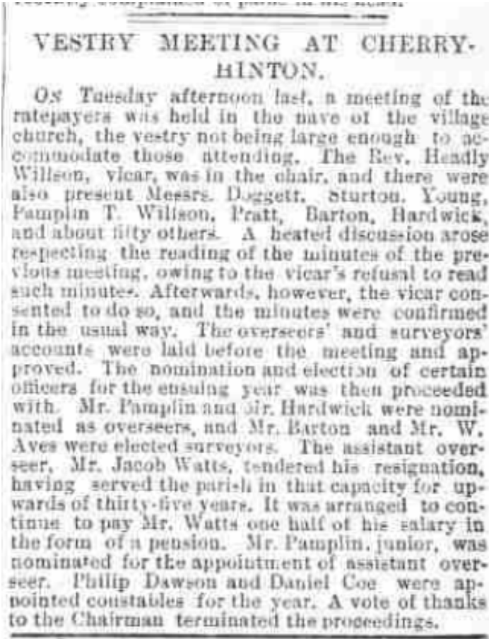
In 1888 at a village meeting, Daniel Coe is appointed constable for the year - this is repeated several times over coming years. Daniel Coe is Matthew's grandson (son of James Barron Coe). See newspaper article below:
30th March 1888 (Cambridge Independent Press, BNA)
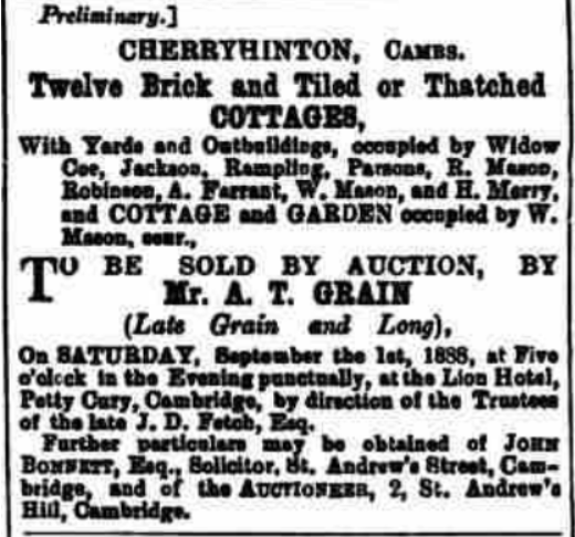
In 1888 mention of Widow Coe is made, occupying a cottage in the village. I wonder which one it is referring to - I'll try and find out at some later point - see below:
10th August 1888 (Cambridge Chronicle, BNA)
Decided to have a quick look at the 1881 census to see if there was any correlation of the names mentioned above in that article, with households living next to, or being listed next to one another. There is. We can see that on the High Street Cherry Hinton, in 1881, there are the following families in listing order: Jackson, Merry, Coe, Tabour and then Farrent. All apart from Tabour, matching a few of the names shown above in the article from 1888. So the cottages mentioned above are likely ones that stood on the High Street.
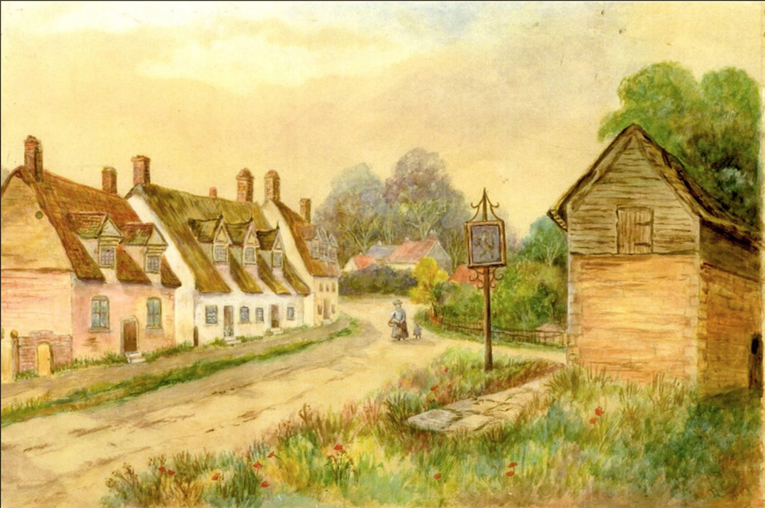
I think I know where these cottages stood...potentially. Some years ago I was arriving at a Cambridgeshire Association for Local History committee meeting in Cambridge Central Library, when as soon as I got in the door, Mike Petty (our brilliant Cambridgeshire Historian) collared me and said, get down to the market (Cambridge) now, there's a painting of Cherry Hinton that is not in the Cambridgeshire Collection and I haven't seen it before. Go and buy it quick! I duly got down to the antiques stall on the Cambridge Market and found the painting in question. Trouble was they wanted £80 for it, which was a lot to me then, anyway, I forgo my bill money and got the painting quick. Later once home, I studied the picture to work out where the view was in the village. I then had a few A3 copies of it made, deposited a copy in the Cambridgeshire Collection and Cherry Hinton Community Archives and then door knocked on a few of the doors of houses, which were stood at the site of the where the buildings in the picture were shown, and sold a few of the pictures to get back some of my bill money. The original painting now lives with Mr David Taylor, chair of the Friend's of Cherry Hinton Hall.
Here is that picture:
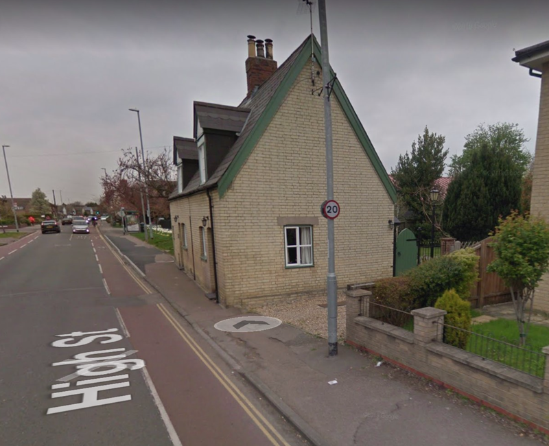
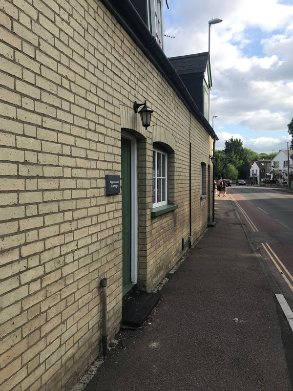
This is a view painted from what was part of the village green in Mill End (a Funnel green), where the Indian Restaurant now stands (previously The Unicorn Pub) looking down the High Street towards the Robin Hood. The buildings in the centre of the picture, above the head of the lady, are the old Robin Hood pub - the tall trees beyond are the start of The Spinny and the quarry on Lime Kiln Hill. The area to the left of the lady (our right as we look at the picture) is where Giants Grave and the village green extended to and which the post office and laundrette now stand on. The road branching off to her left is Mill End Road. The pub sign that you see is a sign for the Red Lion pub which is down Mill End Road and was to direct travellers down the road, as they could miss it if they carried on up the High Street. The building standing on the green is most likely the village pound or a storage building (it is not to say that the Unicorn pub isn't there behind our view at this date but it is not the pub itself).The row of cottages on the left of the painting, you can in fact still see the remains of today if you look carefully. The only fully remaining one of these cottages today, which is again behind us in this view, is Applewood Cottage by the recreation ground.
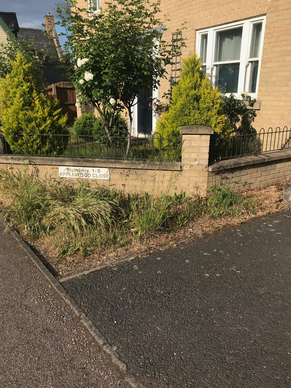
Below pictures of Applewood Cottage and Applewood Close (note the name - does it relate to more of Coe's orchards or just coincidental.) Mrs Coe, mentioned in the news article above, lived along here, maybe in what became Applewood Cottage or one of the buildings shown on the old painting. Note that the style of Apple Wood Cottage is the same of those as in the painting.
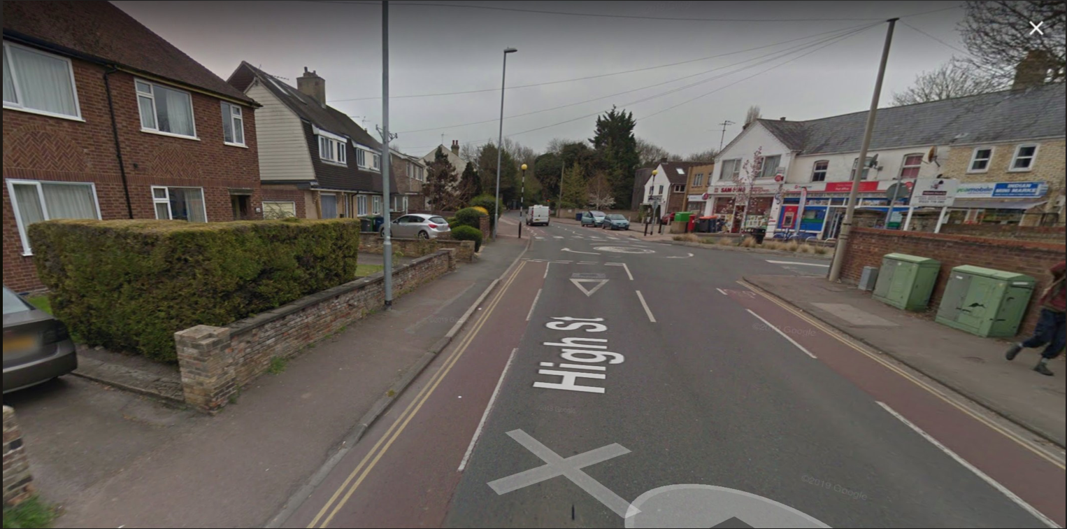
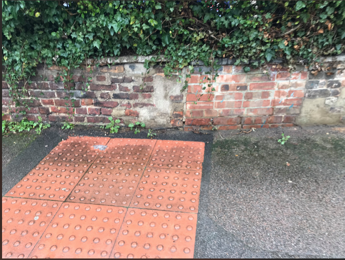
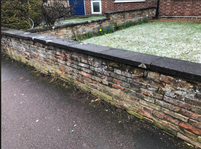
The three pictures below show the remains of the cottages, shown in the old painting, that you can still see for yourself today and are in the garden walls of the houses that are there now - you can even see the old doorways if you look closely. The first photo on the left, below is looking across the road from the Post Office on the High Street. Look at the middle photo, look closer in the front garden wall and you'll see the original cottage wall and a now bricked doorway. 3rd photo on the right shows more of the old brick work from those cottages - one of the Coe families houses? Go and have a look when you get chance yourselves :)
Let's continue onward with looking for the Coe's of Cherry Hinton and Lime Tree Farm....
The first real hint, within the newspapers, of the Coe family being involved and keen on growing a variety of market garden produce, comes with the report in 1890 of the Cherry Hinton Flower Show, where the produce shown by J Coe include such vegetables as turnips, potatoes, onions and beans....(which J Coe though?- probably Jesse?)
1st August 1890 (Cambridge Chronicle, BNA)
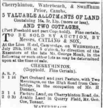
In 1891, George Coe is mentioned in the sale of some land, - see below - which is not on the site that became Lime Tree Farm but shows that the Coe family were very much part of the village by this point, working the land and being involved in village activities. For example, within meeting reports we find that various members of the family are involved with both the Conservative Club and others with the Liberal Club.
18th July 1891 (Cambridge Independent Press, BNA)
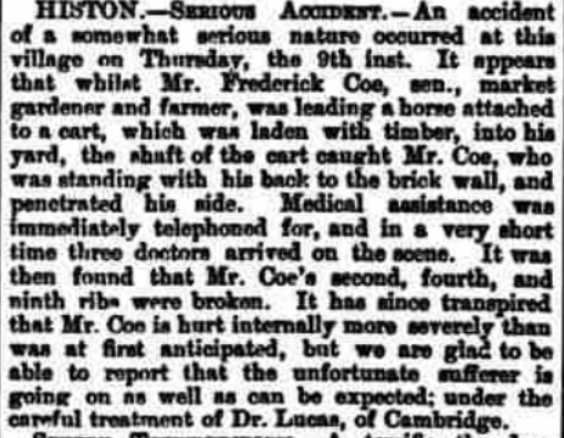
In 1894, we find a Mr Frederick Coe listed, who is a market gardener and farmer. The report however is from the village of Histon, to the north of Cambridge, not Cherry Hinton. It refers to a bad accident that Mr Coe had. But how likely is it that this Coe is related to the Cherry Hinton Coe family? - I don't have him on the Coe family tree yet but it is a very likely possibility that this person, given his profession is part of the same extended Coe family. I will come back to him another time and add to the end of this blog, any links that I discover about this branch of the family, - which is worth looking into because this particular Frederick Coe was born around 1824 in Impington, Cambs. Perhaps we will discover a link to where the first Coe in Cherry Hinton (Richard Coe) came from, perhaps the original family hailed from those parts in the first place? and if you are a Cambridge person you'll know what one of the main occupations Histon became well known for... The Chivers fruit farm and factory, which almost every one in Cambridge of a certain age range can remember working for, or a family member working for at some point - my granny Toller did - I wonder.... given the nature of the Coe's farming if there is any link to what became Chivers... see this is the trouble! A whole new thread to follow and what starts out as a little blog on Lime Tree Farm becomes the start of a book ..... As tempted as I am to go off with this new exciting hint... I will stay in Cherry Hinton for now and maybe add on something at the end of this if I find out more - or I'll just do a separate article on it.
17th August 1894 (Cambridge Chronicle, BNA)
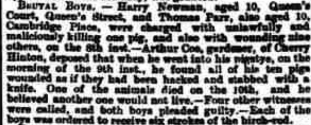
In 1895 we find reference to Arthur Coe as a gardener - most likely Jesse and Delilah's son. If so, this incident occurred on Lime Tree Farm site, as Jesse is shown on the 1891 census, living there at this time.
12th April 1895 (Cambridge Chronicle, BNA)
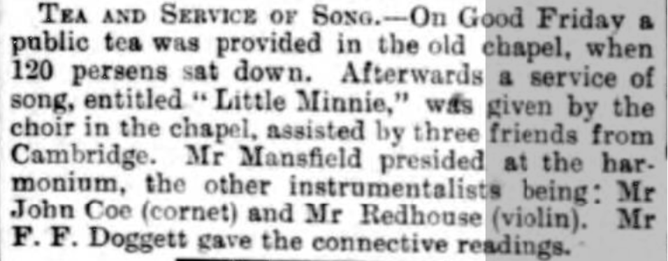
1899 and more evidence of the family enjoying village life with John Coe playing the cornet in the Baptist Chapel on Fishers Lane. John is one of the Coe grandchildren, somewhere along the line.
4th April 1899 (Cambridge Daily News, BNA)
The William Coe mentioned below is probably Charles Coe's son.
18th October 1891 (Cambridge Independent Press, BNA)
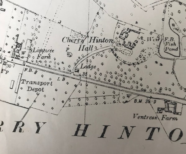
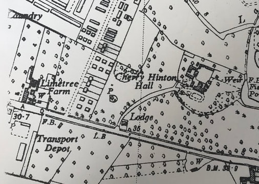
1901 - on the 1901 Os map below, you can see some of the changes that have occurred at the Lime Tree Farm site and the orchards. You can see that the transport depot had taken over the land directly opposite Lime Tree Farm and the dotted, parallel lines marked over the west end of the grounds of Cherry Hinton Hall were marking out where Walpole Road was to be built.
Here's an article mentioning the marriage of George Coe's daughter Lilly, with many members of the family travelling to London for the event. Sadly Jack, her husband was killed in the war, soon after. Lime Tree Farm is mentioned by name in this report.
Friday 24th September 1909 (Cambridge Independent Press, BNA)
So back to which son takes on Lime Tree Farm after George Coe's death in 1919 - Jessie or Herbert? From the newspaper clip below we can see that in 1917, when George Coe was very elderly, that Jesse, perhaps, is already in charge of Lime Tree Farm.
August 22nd 1917 (Cambridge Daily News, BNA)
The death of George Coe is in the papers. The 'Gracie' mentioned is his daughter Lilly Grace.
24th January 1919 (Cambridge Independent Press, BNA)
22nd January 1920 (Cambridge Daily News, BNA)
The probate record doesn't appear to show that much was left, so perhaps, at some time before his death, George had handed over the farm and estate to his son/s.
Herbert Matthew Coe:
Starting with Herbert Matthew Coe 1884-1964. Herbert marries Elizabeth (nee Wright) and they have at least one child, Gracie Elizabeth. They go to live at number 51 Fulbourn Road, where Herbert works as a market gardener with orchards of his own to the back of his property on Fulbourn Road, east of the Robin Hood pub, on the main road through to Fulbourn village. You can see the orchards shown on the 1951 OS map below. There is now modern housing on the site and one of the roads is called 'The Orchards' after Matthew Coe's orchards. (to place yourself - the Cherry Hinton recreation ground is shown top right on the map and the orchards are shown south of this. along the bottom right is Fulbourn Road and running up through the map is Cherry Hinton High Street.)
This leaves George's son, Jessie, living at and managing Lime Tree Farm.
Jessie Coe: Jessie Coe 1883-1973, marries in 1928, Elsie Coe (nee Coxall). They have one son, Cyril. Jessie is listed in the Cambridgeshire electoral records as being a farmer and fruit grower. In 1950, Jessie submits plans to the Council - 'Building bylaw plan and approval for proposed extension to farm shop and Tea Room, Lime Tree Farm, Cherry Hinton Road' (Cambridgeshire Archives: KCB/2/SE/3/9/17630). This suggests that a tea room was already in operation by this point at the site. Elsie Coe ran the tea room and small shop. Jessie and Elsie Coe live at Lime Tree Farm, with their son Cyril, until their deaths, when Cyril then takes over the running of the site.
1939 - The 1939 OS map below shows that although the transport depot is has now taken over land opposite Coe's farm, some of their orchards still remain behind it. This is now the site of the Army Reserve Centre and the back of the Glenmere Close estate.
Below are two advertisements for produce from Lime Tree Farm.
27th June 1939 (Cambridge Daily News, BNA)
12th December 1939 (Cambridge Daily News, BNA)
1950 - On the 1950 OS map below, we can now see that construction of the Walpole Road estate has taken place. The farm still has many of the original orchards that were purchased by George Coe in the late 1800's.
Cyril Coe:
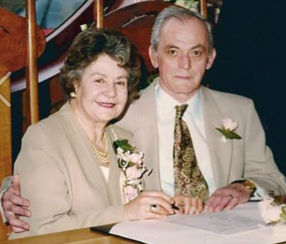
Cyril Coe 1928- 2006, lives at the farm his whole life. He marries Elieen Cooke, who had been previously married and had two daughters. Cyril and Elieen then ran the shop, which was at the front part of the main house, facing Cherry Hinton Road - the one us locals remember the most.
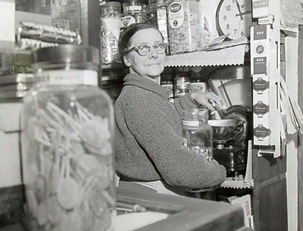
1964 The picture below comes from Mike Petty's Cambridge News archives and it is believed to show Mrs Elsie Coe, Cyril's mother, working in the shop at Lime Tree Farm.
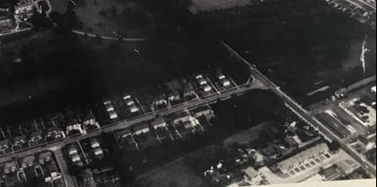
1964 - The aerial view of Lime Tree Farm from 1964 shows the farm in the bottom right, with Dewent Close beneath it and Walpole Road now built above it. You can see the site of the transport depot opposite the farm and the orchards continuing over the road in what was to become Netherhall School lower, front playing field.
1973 onwards...After Jessie's death, his wife, Cyril's mother, Elsie, stayed on at the farm with her son, his wife Elileen and the children. The orchard farming had ceased with the land being sold off and most of it becoming the Netherhall School lower, front playing field.
My uncle married one of Mrs Coe's daughters and as I only lived a little further down the road, on Cherry Hinton Road, I used to go and play with my aunts kids at Lime Tree Farm, where we would climb about in the old barns and hay lofts. I can remember being sent, by my mum, up the road, to go to the little shop to buy a tin of meatballs from Mrs Coe.
By the late 1990's Cyril and Eileen had moved out of the old farm house and had a new bungalow built for themselves next door. They then sold off the old house and the land behind which was once the farm. A new housing site was constructed and is named Coe's Court. Before long, all of the old barns and buildings had disappeared and with Cyril's death in 2006 and Elieen's death in 2009, the end of Lime Tree Farm and the Coe's at the site came to an end.
More pictures of Eileen and Cyril and the shop - coming soon
I have started a public family tree for the Cherry Hinton Coe family on Ancestry, to provide further information and gather more records. You can view it here:
Coe Family Tree
I hope this has been of some interest and use, in particular to Cherry Hinton residents and anyone researching the Coe family tree. Every now and again, I'll come back to this and add, edit and adjust as I get new pieces of data and information. Perhaps, you may feel inspired to do a bit of research yourself, which would be brilliant! I've started listing a few things that could be looked at further, below. This is not extensive of course but just a few things, that are thoughts to follow up. Research is never done and always throws up more questions than answers :)
Further research to be done:
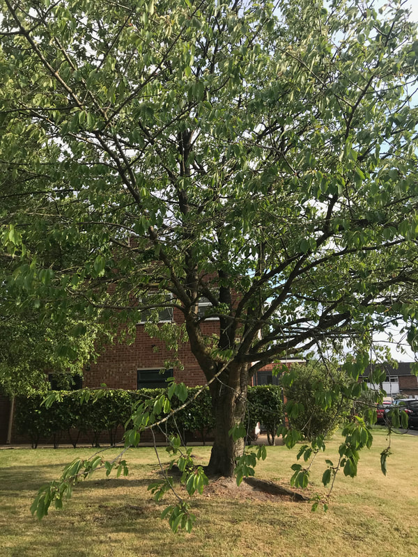
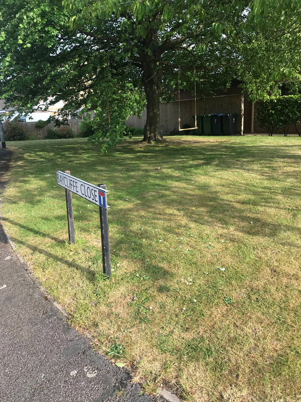
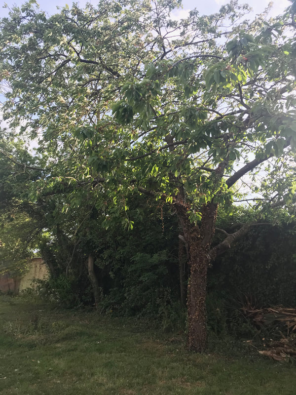
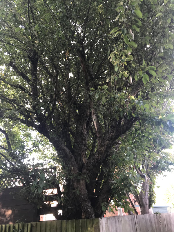
Where did the first Coe come from - Richard Coe, where was he born, what was his occupation etc? Which one of the Coe's first got into the market gardening business? Did they sell their produce at the Cambridge market? what about further afield? or were they wholesale suppliers? What fruits, vegetables and produce were they producing, other than those mentioned in the adverts above? Did any of the Coe's work at the Cherry Hinton Hall kitchen gardens and orchards, when John Okes was in residence (c.1835-1871) or afterwards (c.1930 - 1990) when the Council nursery was in operation at the back of the Hall, producing plants for the counties parks and roundabouts etc? Other that Lime Tree Farm, where else in the village were Coe's orchards and gardens, if any others? Did any descendants go off into other villages and towns, continuing the market gardening business, if so where and are any still running today? How many of Coe's descendants are still living in Cherry Hinton? How many of their original trees, from the old orchard plots, still remain in peoples gardens unrecognised for what they were part of? - couldn't resist having a little general look around for this one - all where plots 5 & 6 would have been and the original George Coe's orchards, shown on the 1883 sale map - see photo gallery below. There were a lot of much older cherry tree stock along with many apple trees and other cherry trees around - separating out what is modern garden planting, to what remains of any of the Coe's orchard stock and the descendant trees is a challenge that would need revisiting. Find out more about Frederick Coe born 1824, market gardener of Histon and see if there are any links to the Cherry Hinton Coe's and also to what eventually became Chiver's of Histon? Other pictures of the Coe family/Lime Tree Farm site.
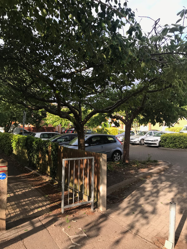
Looking for old fruit tree stock, from Lime Tree Farm, that may remain today.
Below: Coe burials in St Andrew's Church Yard, Cherry Hinton. These are from the survey's and records which myself and Mr Clarke made in 2005.
Update on the Coe/Chivers connection - so, do you remember the Frederick Coe, mentioned in the newspaper article of 1894 above, who wasn't part of the Cherry Hinton Coe's but was a market gardener living in Histon? I had not only wondered if they was a link to the Cherry Hinton Coe family - still looking at that - but if there had been a link to Chivers of Histon, the famous fruit growers and jam makers...well, there is of sorts. Frederick Coe, his wife Susannah and their children live next door to Stephen Chivers, with his wife Rebbecca and their children - as shown on the 1861 census. The two families live north east of the green in Histon and Steven Chivers is a farmer and gardener of 140 acres, employing 9 men and 5 boys - it is Steven Chivers who starts the great Chivers enterprise. So they were at least neighbours, in dwelling and fields. In addition to this their family links go back a little further as Frederick's father, James Coe, also a gardener is living next door to John Chivers in 1832.
In addition to that the next thing I find out is that Frederick Coe takes a Thomas Chivers to court over damage of his market garden produce - see article below - so although it is not currently a connection in quite the way I'd imagined, it is still something worthy of note and interest.
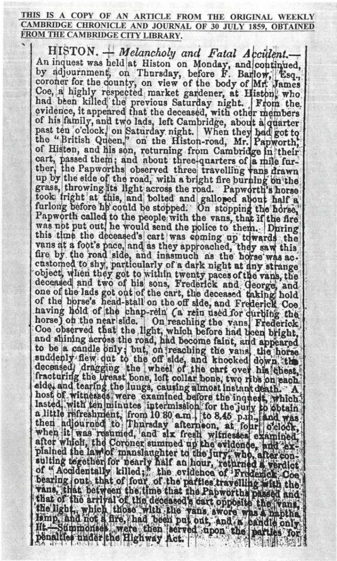
Although this strays a little from sticking to Cherry Hinton history, I couldn't resist sharing this with you too. The article below describes a tragic incident involving James Coe, Frederick Coe of Histon's father. It struck me how, not only did Frederick witness this incident, but how we had begun our discovery of him with a near fatal incident of his own, which must have reminded him of his fathers fate.
If you'd like to support the work that I do, why not buy me a coffee, I'd be really grateful and it will help keep me going :)
©Michelle Bullivant, May 2020
8 Comments
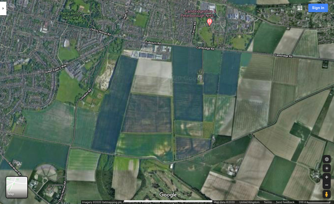
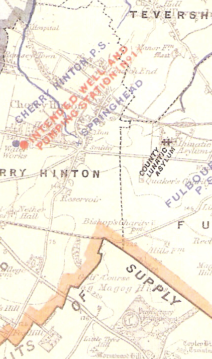
The Tutton (or Tottenhoe) Way is an ancient route-way that skirts the eastern edge of Cherry Hinton old parish, now Ward, and now also forms the eastern Cambridge City Boundary.
VIDEO 1 of 3 - Tutton Way
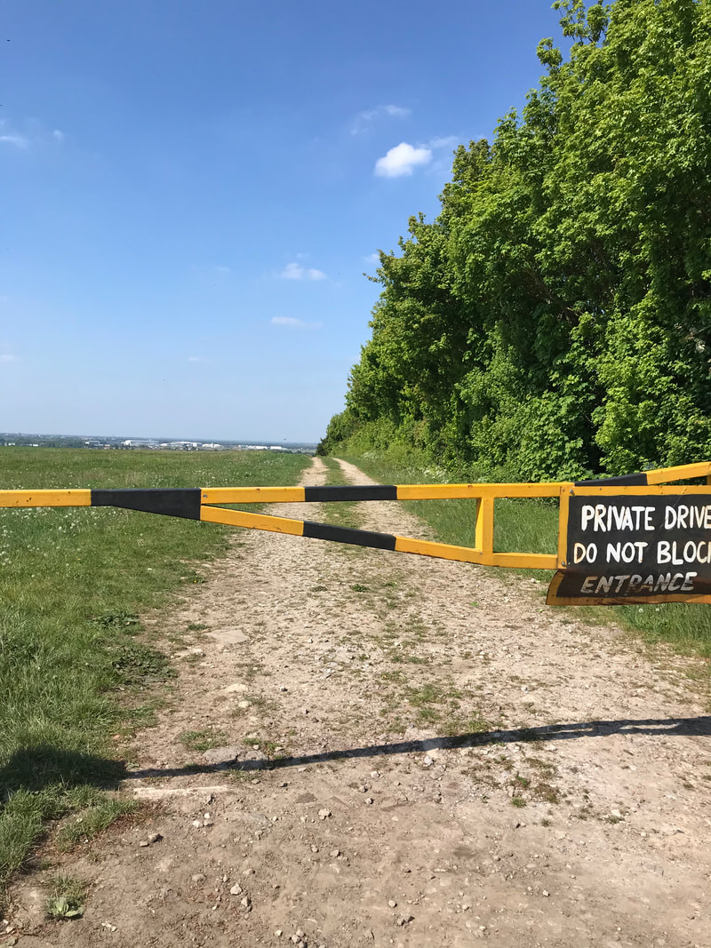
I can, so far, trace this boundary from the northern end of Bridewell Road in Cherry Hinton where it joins Fishers Lane, following through the back gardens and the line of this routeway south, to meet up with the small passage way at the other end of Bridewell Road, that leads through on to the Back Field, where it continues on in the form of a paved footway to join Fulbourn Road. It then crosses straight over Fulbourn Road and enters the northern boundary of the Gog Magog Hills, where it travels up through a field edge as a trackway, going first alongside the eastern edge of the Peterhouse Technology Park and then continues up over the hill, in a straight line, through the fields as a wide trackway (currently closed to the public). The Tottenhow Way then meets the Worts' Causeway Road at one of the highest points on the Gog Magog Hills, where, straight across the road, it continues, for a short way, as a wide trackway named the Shelford Gap before apparently ending at the thick hedge line beyond which the Gog Magog Golf Course lays. It also meets the apparent end of the Roman Road, collectively known as Worstead Street or Wool Street. The Roman Road leads off of the end of the Shelford Gap (Tutton Way) in a south easterly direction, in a long straight line for many miles.
VIDEO 2 of 3 - Tutton Way
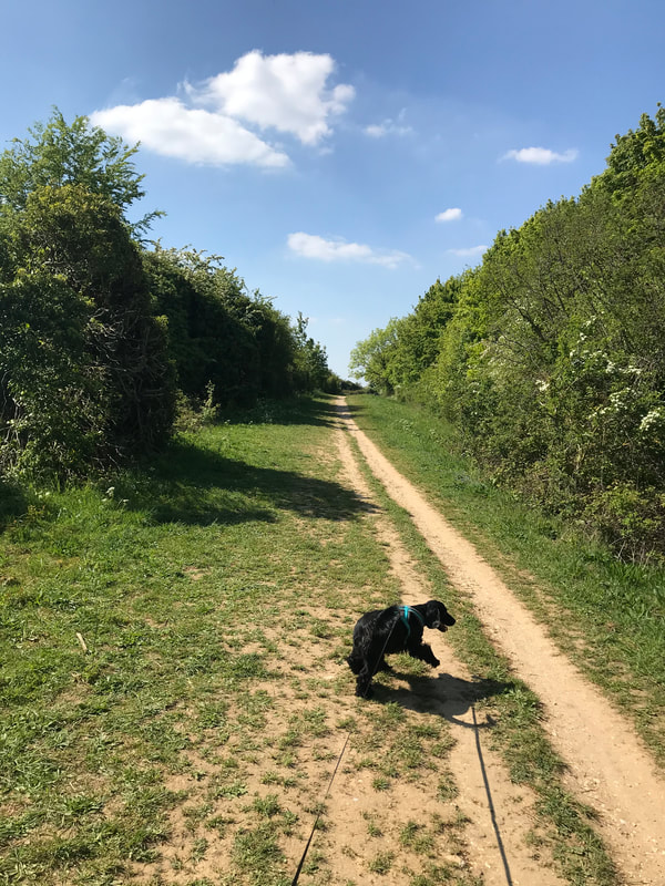
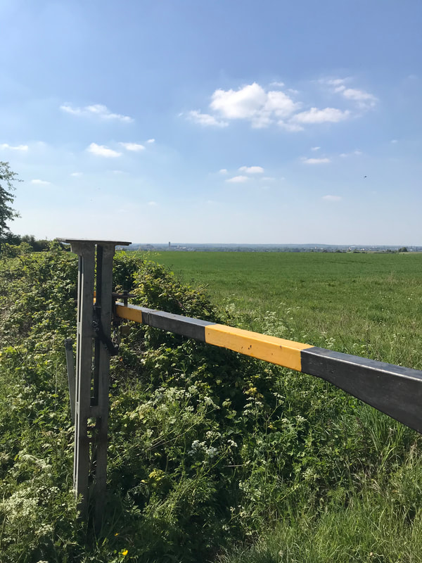
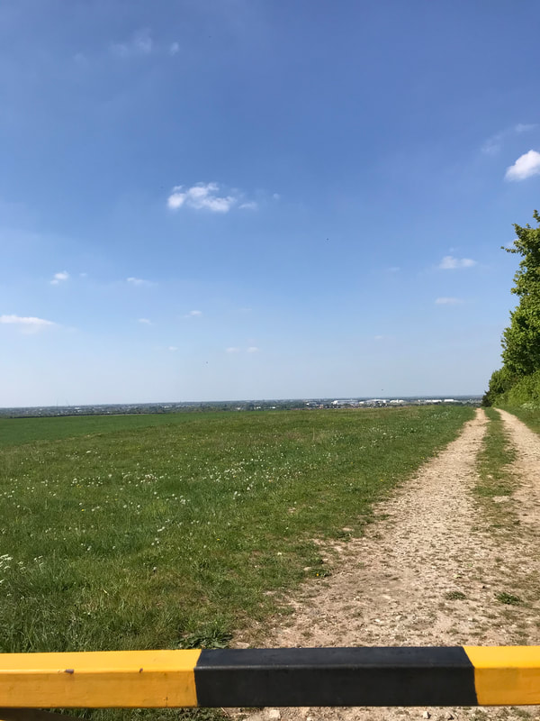
There is a little bit of a dirt track entrance/parking on the roadside by the start of the Shelford Gap on Worts' Causeway and barriers to prevent vehicles driving down the track but it is a popular place to start the walk down the Roman Road. However, it’s not very advisable to go there alone and there are, shall we say, interesting individual and collective, unusual activities that go on at that spot, particularly as there is a small wooded area alongside the trackway. It is not really very safe to walk up to this point as there is no real safe footpath from Cherry Hinton, so going by bike or car is currently the safest way.
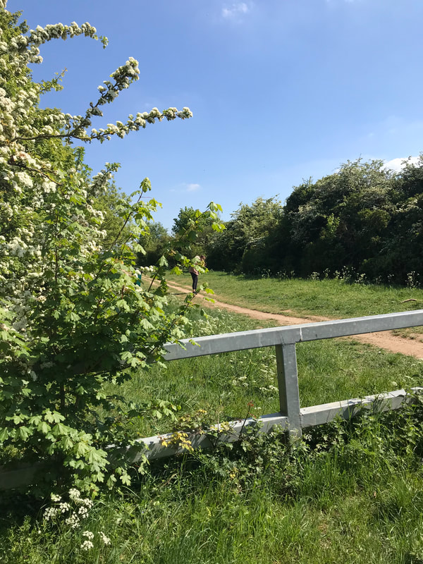
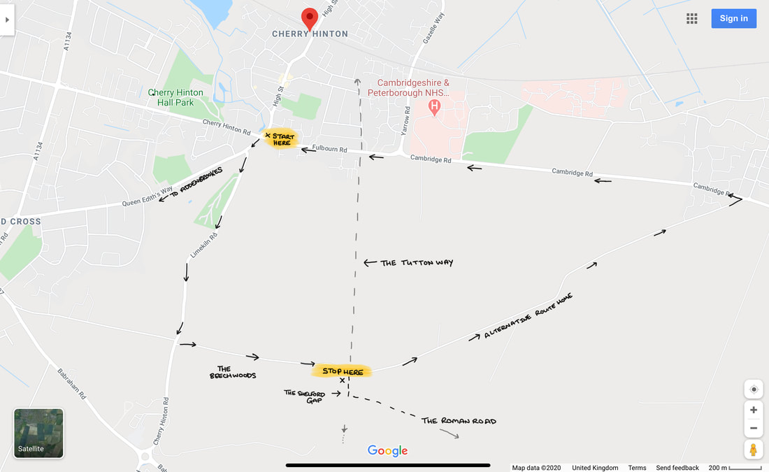
From Cherry Hinton the route is taken, starting from the Robinhood at the junction of Cherry Hinton High Street and Cherry Hinton Road. Go straight over onto Queen Edith’s Way. Take the first turn on the left to drive over Lime Kiln Hill, at the immediate base of Lime Kiln Hill, where there is a crossroads. Take the next left to drive up Worts' Causeway, passing the Beech Woods on your right, continue up the hill until you reach the crest, where you will see the parking area for the Shelford Gap on your right hand side. You will be able to cross the road on foot to look north over the Tutton Way and see the spectacular views across Cambridge, Cherry Hinton and beyond. If it is a very clear day you will also be able to spot Ely Cathedral in the distance (about 20 odd miles away.)
Once you’ve finished your visit you can either go back the way you came or you can continue along the road eastwards, turning right, as you come out of the Shelford Gap on to Worts' Causway, where it then becomes Shelford Road. It will lead you over the hills, with lovely views, where you’ll also be able to see the sails of the Fulbourn windmill on your left as you make the descent down towards the village of Fulbourn. At the bottom of the road you’ll meet with Cambridge Road and mini roundabout, where you can turn left and follow the road straight back to the Robin Hood pub in Cherry Hinton.
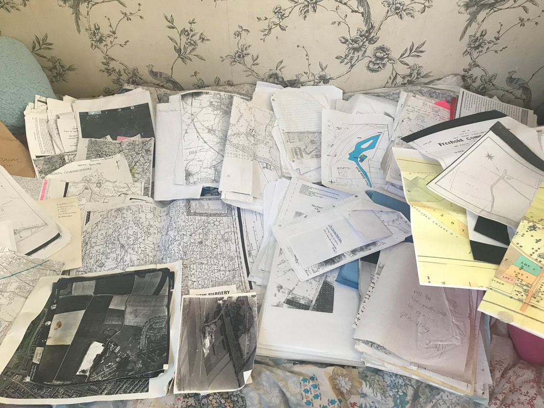
I think, on the whole, hardly anyone today knows about the existence of the Tutton Way, other than the people who remember me talking about it when giving local history talks to groups, where I would mention it now and then. I had found out about it from reading old documents, maps and surveys from Cherry Hinton when doing my research on the village over the years. Being stuck in isolation during the lockdown is giving me chance to write up a few things that I’ve been meaning to write about for some time, including the ever-allusive Cherry Hinton Local History book that I’ve been promising to write for years. So, I thought I’d start with writing about a few of the places you can walk to or get to, for nice walks and offload some of the information and theories about the archaeology and local history of the area, out of my head and onto paper/screen, with an idea to start forming the book that I must get done.
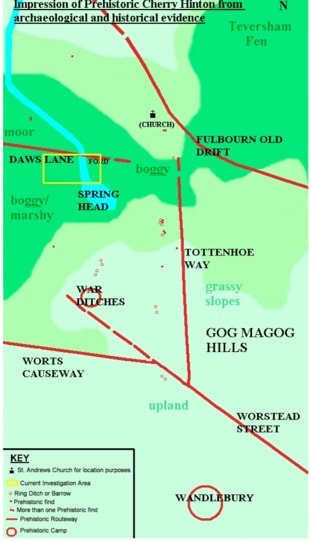
Prehistoric Cherry Hinton Map ©Michelle Bullivant 2010
The map above, that I made some time ago, gives you an idea of some of the routeways and sites in and around Cherry Hinton during prehistoric times. I have placed the current main church building of St Andrew's on the map just to help you get your bearings. You can see the Tutton Way (Tottenhoe Way) that we are discussing, you can also see the Roman Road and the projection of its, potentially earlier route. You can also see the hillforts of Wandlebury and the War Ditches. I also mapped out the (at the time) known burial (barrow) sites, showing their relationship to the routeways. It just gives you a basic illustration of the area that we are looking at and makes the point that you can often tell ancient (pre Roman) boundaries and route-ways as they are often have barrows and other markers along their course.
At the end of the Shelford Gap, near to where it meets the Roman Road, were once two locally known barrows, nicknamed the Two Penny Loaves: "Smith's carrier's cart turned right from Fulbourn, heading south into rolling countryside. All the way it creaked ever upwards, till at the top of a ridge they reached an ancient track which was apparently an old Roman road linking Cambridge with Colchester, the way marked by two barrows, called by local people the "Two penny loaves" (Pickwick's Cambridge Scrapboook 1838, Mike Petty) "At this point, where the road returns to its original direction, there are the remains of two tumuli, called the Two- penny Loaves, one of which was opened in 1778, and seven skeletons were found at its bottom ; six of them were laid close together and parallel, with their heads pointing due north, the other lay with its head directed due west, and its feet next the side of the nearest of the six (Nichols's Lit. Artec, viii. 631)" (Ancient Cambridgeshire, by Charles Babington, Cambridge Antiquarian Society)
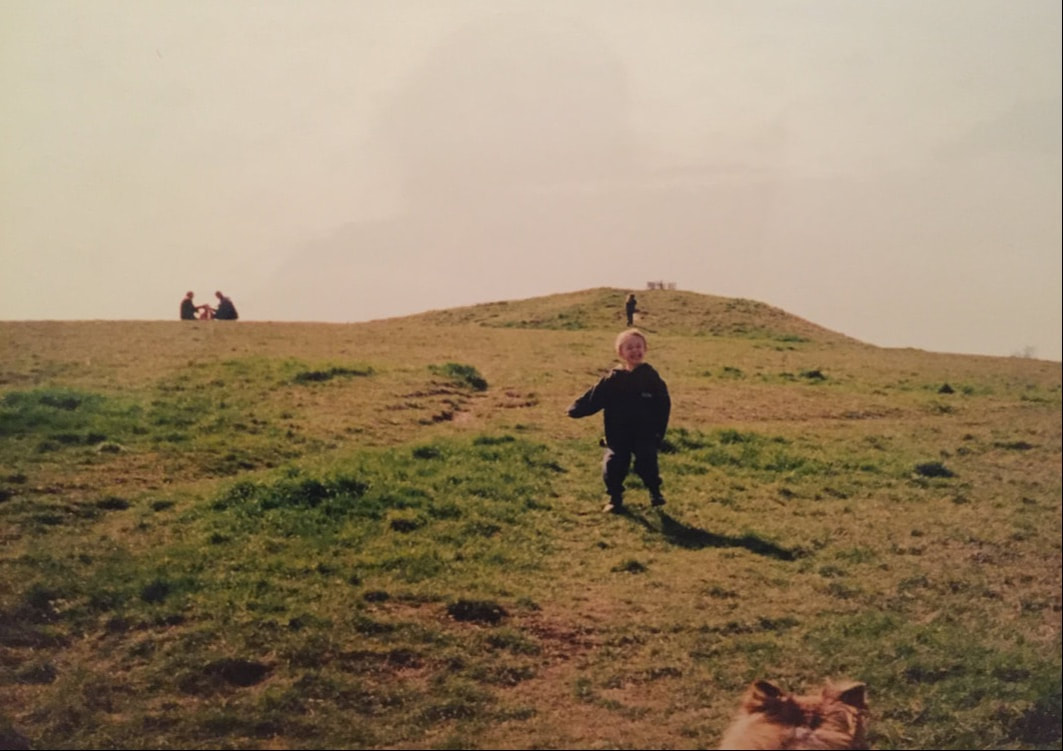
The picture above (with my son in the foreground and daughter climbing in the background, many years ago) gives you an idea of what Bronze Age burials mounds, or barrows as they are also called, look like. The one above is situated on Thurfield Heath in Royston, not that far away. You may often drive past them at the side of roadways and not realise what they are, a good example is of the one on the A11 as you drive towards Norwich from the 5 went ways roundabout at Barton Mills. The Two Penny Loaves would have looked something like this, standing side by side. However their fate, as with many of these barrows, was that they were excavated and destroyed, with the majority of barrows being ploughed away over the years to only occasionally be seen on aerial photographs as a crop mark on the ground. After lockdown, I will see if the Gog Magog Golf Club will let me go and have a look for the site of the Two Penny Loaves and report back to you if any sign of them remains.
One of the earliest descriptions that we have of the layout of some of the land in Cherry Hinton comes from a written survey of the Manor of Netherhall in the Parish of Hynton from 1592 (Separate articles on the Manors of Cherry Hinton and place names in the area soon). Unfortunately this survey, carried out by Christopher Saxton (you can read about him on Wikipeadia), is a written survey only with no accompanying map that we know of. This means we have to go by the written descriptions within the old open fields of the parish to work out where he is talking about.
The main open field that the Tutton Way traversed was called Quarry Field, it was a large area covering across from Lime Kiln Hill, on the Gog Magogs, eastwards to the parish boundary (the Tutton Way). Saxton gives the following description and land measurements:
"Quarry Field... The Furlong abutting the Totton Way - One piece lying in the lands of ..Junior South - 1 acre, 0 roodes, 5 dawks and 3 pches One piece laying between the lands of Uphall on the east and Gilbert Wise on the west - 0 acres, 2 roodes, 8 dawks and 2 pches" (London Metropolitan Archives, H01/ST/E/106/002) So here we see the first known written mention of the Tutton Way - spelt by Saxton, as 'Totton'
The next reference to the Tutton Way can be found in the Survey of St. Thomas' Hospital Land in Cherry Hinton, 1733 by John Tracey. (Survey of Hospital Propery at Cherry Hinton, by John Tracey, 1733. London Metropolitan Archives, H01/ST/E/107/003) which again was a written survey based within the old open fields of the parish but this time, contained three simple maps. One of which shows the route way, within Quarry Field, called Tutton Way. I'll order a decent copy of the map and place here, after lockdown, so you can have a look.
Here you can read a bit more of a very good, general overview about the Roman Road, written by my friend and colleague Tim Malim. You will see that this link takes you to the Friends of The Roman Road & Fleam Dyke website, where you can have a little bit more of a look at their take on the Cambridge Dykes. I will do a separate article or two about these and The Roman Road myself at some point soon because if I start on these now I’ll get completely side tracked and loose my focus on the Tutton Way - research is never really done!
https://frrfd.org.uk/archaeology-and-history/roman-road/
If you want to know a bit more about Wandlebury, for now, you can follow the link below, to take you to the Cambridge Past, Present and Future website, who look after the Wandlebury site.
https://www.cambridgeppf.org/wandlebury-history And more on the War Ditches can be read here, linked from the Wildlife Trust website who now manage and care for this particular site. https://www.wildlifebcn.org/sites/default/files/2018-05/East%20Pit%20Archaeology%20Report_0.pdf Again, I will write something further on both Wandlebury and the War Ditches at some point soon and post here on my website for you but I just need to focus on one thing at a time or I shall be drawn into writing great reams of theories, arguments and never actually getting anything up and published for you.
The earliest maps and surveys, that I’ve mentioned above, call the routeway the Tutton Way or Totten Way, where as I have seen it also named the Tottenhoe Way on a later map. There are a couple of possible meanings to this name – If we start with the earlier ‘Tutton’ it could be a derivative from the word ‘tot’ meaning fool or idiot, perhaps indicating a more perilous routeway – the fools way. Another thought is that ‘toten’ is the German word for ‘dead’, suitable for an ancient routeway lined with the burials of the ancestors perhaps? However, the later used name of 'Tottenhoe' makes a little more sense in many ways, as Totternhoe is a village in central Bedfordshire where the Totternhoe stone is sourced, now bear with me, as this does relate to our site in some regard – Totternhoe stone is not hard stone, it is a seam of very strong, durable chalk which was quarried in that area for use in great buildings, such as Westminster Abbey. Here in Cherry Hinton, from at least the Roman period, the strong building chalk, known as clunch, has been quarried and in turn used in such buildings as Peterhouse College and Ely Cathedral. You can see the evidence of this at East Pit off of Lime Kiln Hill, in the large open quarries there, which is only a stones through from our Tutton Way. Perhaps the name related to this strong chalk and its quarrying industry. Does the chalk seam run from Bedford through Cambridge? Burwell village, to the north east of Cherry Hinton, also used to have chalk quarries where the Burwell Rock would be quarried for building use in similar ways.
A quick google for you, rather than me spending ages going through the piles of old maps that I have here, reveals some further information, from Cambridgeshire Geological Society, which gives this latter theory more credence as being the most likely for the naming of our routeway. http://www.cambsgeology.org/565-2-3-2
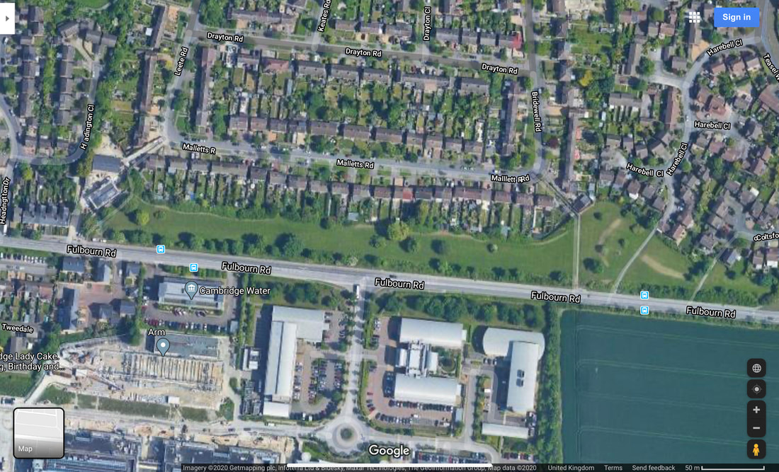
If you go onto the Back Field in Cherry Hinton, at the eastern end where a passageway leads through on to Bridewell Road, you can stand on the Tutton Way as it cuts over the back field in the form of a wide paved pathway, which leads out onto Fulbourn Road. Once out onto Fulbourn Road, you will be able to see that this spot also marks the official Cambridge City Boundary, with a sign, again highlighting the importance of this ancient boundary. The back field is a Cambridge City Council owned green space which local residence use to walk their dogs and the staff, at ARM across the road, come out to have games of cricket and sit and enjoy their lunch. In the autumn there are great amounts of blackberries to be picked and in the spring the boundaries are covered in yellow daffodils. The Back Field runs from the passageway that runs into Leete Road, off of Fulbourn Road and it ends just before the hedges as you approach the roundabout at Yarrow Road, Fulbourn Road junction.
VIDEO 3 of 3 - Tutton Way
The Tutton Way can be seen in the form of an earthwork running along inside the back gardens of the houses on the eastern side of Bridewell Road. My mum used to live down the end section of this road and there was a large, clear slope running up and through her back garden which was not a natural slope but man made.
The map above (which you can see in full on the Cherry Hinton Community Archives website), shows the parish boundary marked by a dotted black line. As it stands and from what we (you and I) now know, the Tutton Way ends were it joins the old Roman Road at the end of the Shelford Gap, however, you can also see that if you were to draw a straight line from this point over the Roman Road, that the Tutton Way would lead straight into Wandlebury hill fort. I would strongly suggest that it did just that, once upon a time.
If you then follow the Tutton Way north, across the field and back towards Cherry Hinton village you come to a point where the parish boundary abruptly turns to the right, up and then to the left again, creating a off set square shape. The point at which the boundary turns is where the Tutton Way ends, as far I can tell at this time. This point is at the bottom of what is now Bridewell Road, where it meets Fisher's Lane in Cherry Hinton. The odd square actually marks out where there was once a some common land, it was called Drayton Common. It can easily be imagined that cattle were put out to pasture on the common land at this point and then driven up onto the higher ground, along the Tutton Way, perhaps in even earlier times, all the way into Wandlebury encampment itself. However, more research and on the ground field work is needed to really test out and explore if this really was the extent of the Tutton Way. It good fun to get out the maps and look on aerial views of the site and see if we can look for clues and trace the line of this old route way any further - perhaps the route continued across Drayton Common to meet at the crossroads by the church, with what is now Church Lane, the High Street and Fulbourn Old Drift? Or did the route turn at some point and join Daws Lane which runs bend Cherry Hinton Hall and was one of the old route-ways into Cambridge? etc. etc..
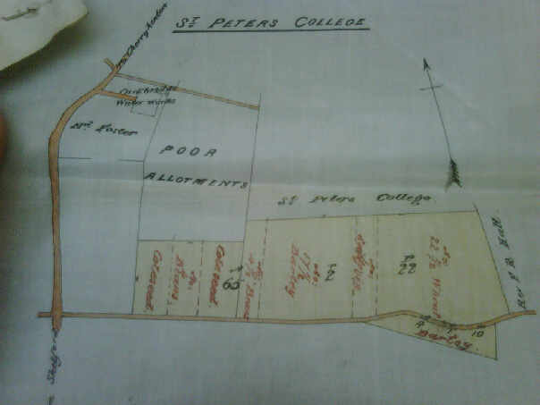
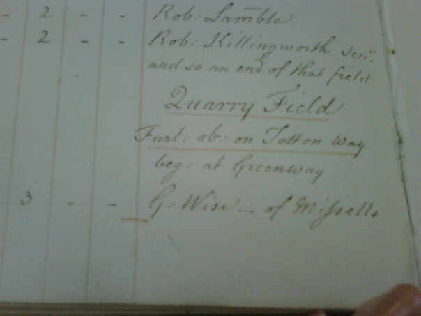
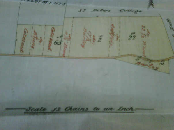
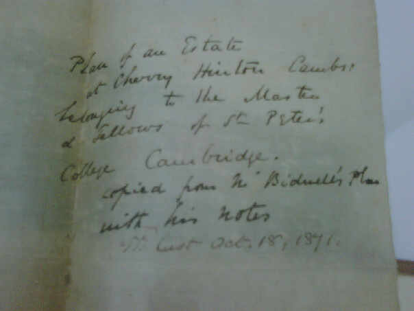
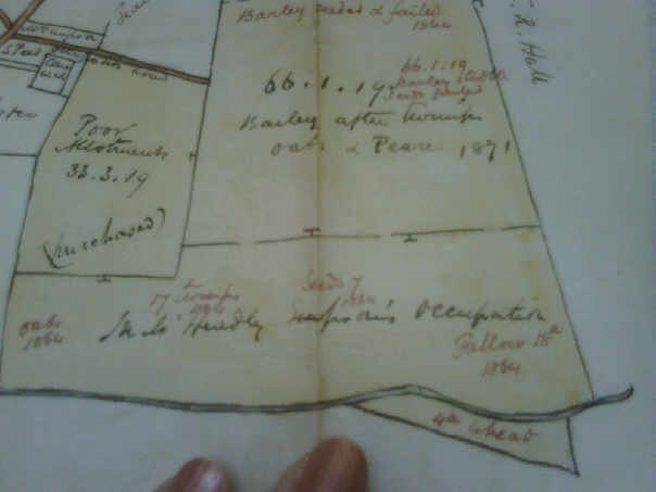
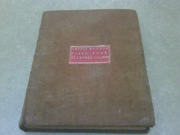
Below are a selection of photographs that I took of some of the records held by Peterhouse College, who owned a lot of land in Cherry Hinton. I am afraid that the pictures rea not very good quality as they were taken some years ago on an old phone or camera, so I must get back to Peterhouse to get clearer images. The pictures below cover the area around the Shelford Gap and are from the 1870's, recording what crops were grown and if they were successful etc. The important thing of note is that within the written columns Quarry Field is mentioned along with "Furlong abutting the Totten Way" - so the name was still in use for this route way around this date.
As always, research is never finished and theories evolve as more data becomes available but they must all start somewhere - an idea, a clue and most importantly curiosity. I will add to this and any other of my posts as and when I discover some new piece of information to add, in the meantime I hope this has been of some interest to you all :)
If you'd like to support the work that I do, why not buy me a coffee, I'd be really grateful and it will help keep me going :)
|
Cherry Hinton History Pages:
Contents If you'd like to go straight to a specific article or blog post within the Cherry Hinton History Page you can click on any of the post titles in the list below and it will take you directly there. Alternatively, you can use the search box above to search by keyword or you can use the index further below. About & how to use:This is the blog page for my articles, memories and archives relating to the archaeology and local history of Cherry Hinton, a village to the southeast of Cambridge UK. The area covered is the old Parish of Cherry Hinton which today includes the Ward of Queen Edith's. The Categories below are really the keyword index of what is on the Cherry Hinton History Pages. Each is a clickable link which will take you to an article or blog which contains that word or subject.
Categories
All
Archives
May 2024
|
